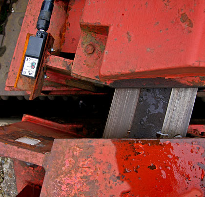
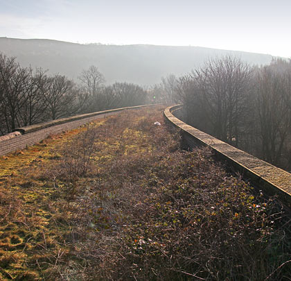
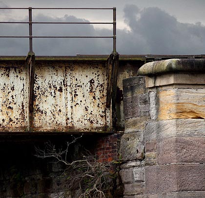
Wylam Bridge
Wylam Bridge
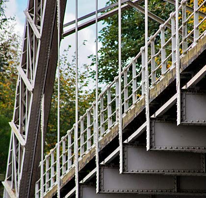
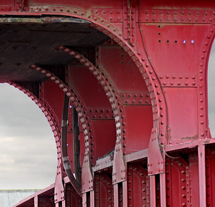
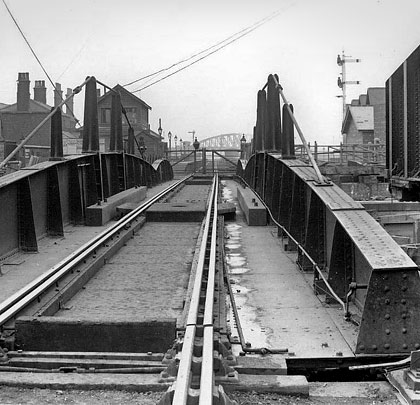
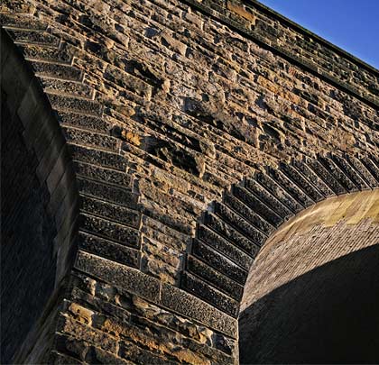
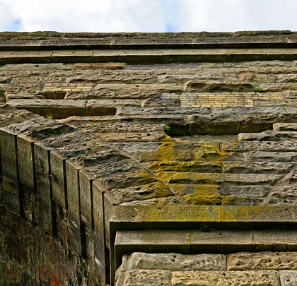
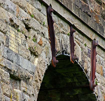
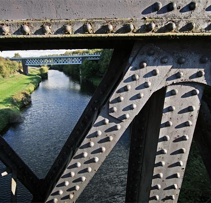
The bridge comprises three main wrought iron girders, including one down the former six-foot.
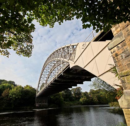
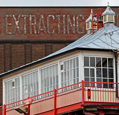
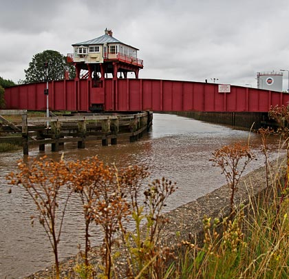
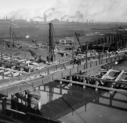
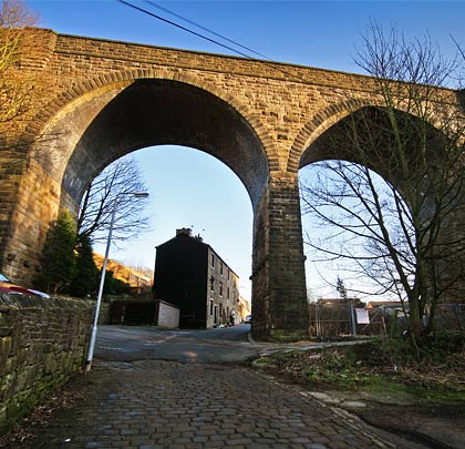
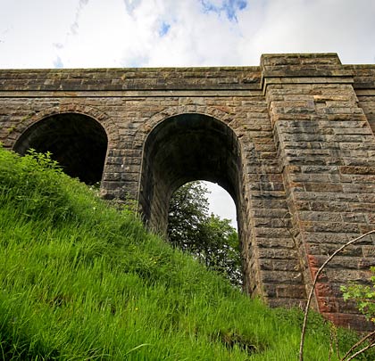
Now Grade II* listed, this grand span of the Tyne goes by many names – Hagg’s Bank Bridge, Points Bridge and Half Moon Bridge amongst them. We’ll just call it Wylam. It hoisted the colliery-serving Scotswood Newburn & Wylam Railway, known as the North Tyne Loop, over the water within whistling distance of its junction with the Newcastle & Carlisle.
The original plan was for a more conventional bridge, with three piers standing in the river to support four short sections. But this was opposed by the local coal companies who feared for the integrity of their shallow workings which were already suffering from flooding.
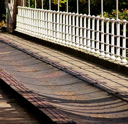
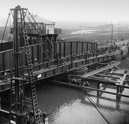
Instead an elegant single span, engineered by William George Laws (later the City Engineer for Newcastle) and comprising three wrought iron lattice girders, was slung across the river. From these, the twin-track decks were suspended, resting on transverse beams that were held by 15 drop bars.
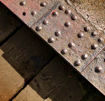
Costing £16,000, the structure helped to push the boundaries of bridge building. Its ironwork was fashioned by Hawks Crawshay & Sons of Gateshead whilst Newcastle’s W E Jackson & Co built the foundations and abutments. The first revenue-earning train crossed it on 6th October 1876.
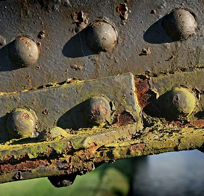
Closure came on 11th March 1968 but the bridge was later bought and restored by Northumberland County Council. It was listed in 1985 and reopened as part of a footpath in 1997.
 January 2011
Wylam Bridge
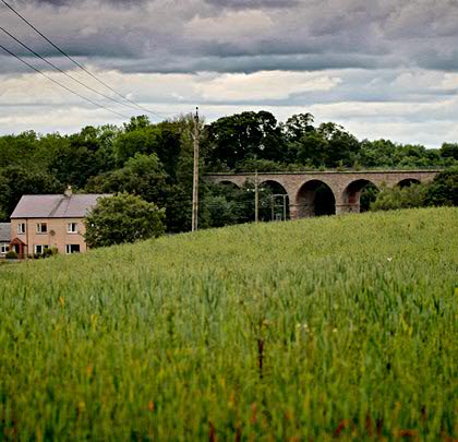
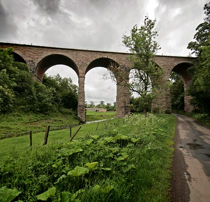
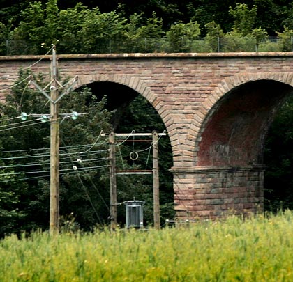
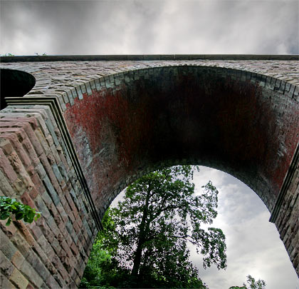
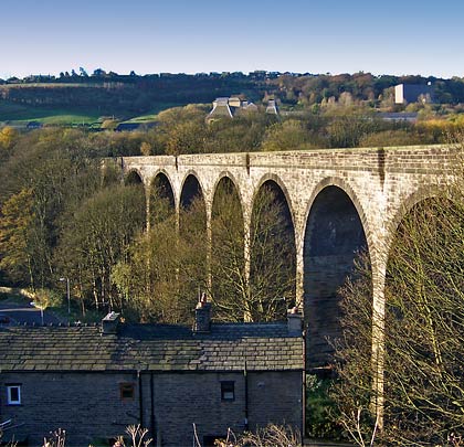
Woolstone Viaduct
Viewed from the adjacent road, the concrete structure does a passable immitation of masonry.
With the opening of Bude Station on 10th August 1898, the London & South Western Railway completed its 28-mile branch from Okehampton which had taken 19 years and four Acts of Parliament to fulfil. The line was originally built as far as Holsworthy, seeing its first trains in January 1879. But when the company showed no sign of extending the route westwards towards the coast, the residents of Stratton and Bude raised £1,000 towards the cost of promoting a bill for a 9½-mile extension that would visit the two towns.
The L&SWR took up the offer and the Holsworthy & Bude Railway Act passed in August 1883. However, apart from a ceremonial sod cutting, no works were undertaken and the L&SWR soon sought the scheme’s abandonment, authority for which was granted in May 1892. Thereafter, the company was again lobbied to advance its line, resulting in another Bill being passed on 6th July 1895. This though involved a substantially cheaper route, bypassing Stratton altogether.
Responsible for its development was William Galbraith who had been appointed the L&SWR’s resident engineer on the death of John Errington in 1862. Contracted to deliver the works was John Aird & Co. Two viaducts – both now Grade II* listed – formed parts of the scheme, one near Helscott and the other quarter of a mile west of Holsworthy’s station. Their construction was influenced by a local dearth of stone suitable for heavy works, driving the choice of concrete. However sand had to be brought all the way from Plymouth and Bideford.
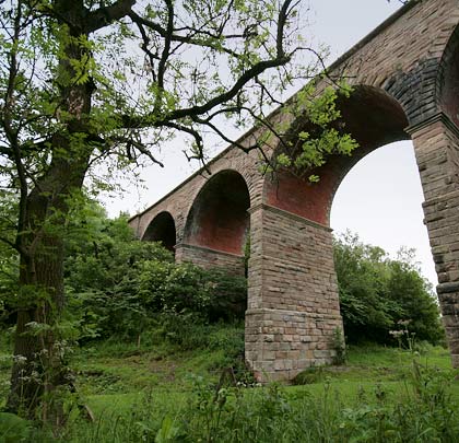
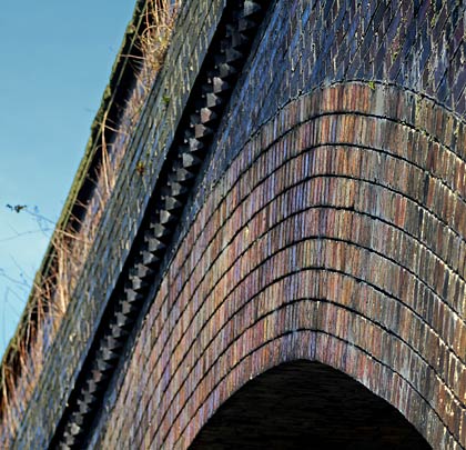
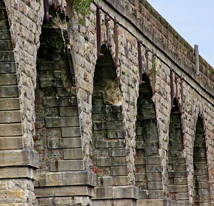
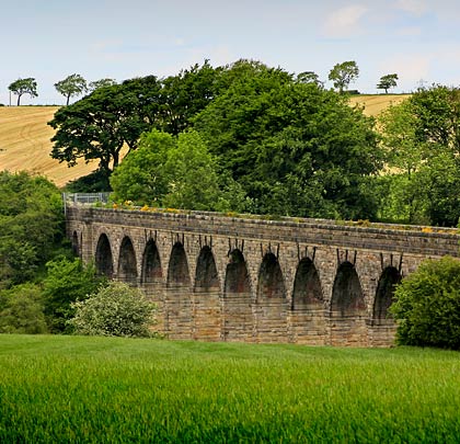
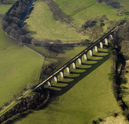
The viaduct near Helscott went by the name Woolstone – a farm just to its west. Featuring five arches, it follows a straight course for a little over 80 yards and reaches a maximum height of 65 feet. The structure was built from concrete blocks – one of the first to benefit from such an approach – and comprises arches springing from chamfered imposts on piers of rectangular section. The parapet has a moulded cornice; below it is a string course. Above each pier is a corbelled-out refuge, one of which has a datestone carved into it.
The line over the viaduct closed on 3rd October 1966.
(Crispin Purdye’s photo, taken from Geograph, is used under this Creative Commons licence.)
January 2011
Woolstone Viaduct
Wilmington swing bridge
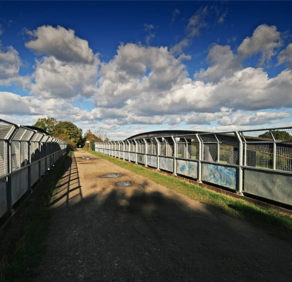
The Grade II listed structure was converted to carry a footpath and cycleway in 1991.
(Photo 1 © Crispin Purdye, photos 2-5 © Andrew King)
Now Grade II listed, the swing bridge over the River Hull at Wilmington was a replacement for a single-track structure on the Victoria dock branch of the York & North Midland Railway which opened in 1853. 5th May 1907 saw the new one enter service. Although closed to rail traffic since 1968, the bridge was converted to form part of a footpath in 1991. This runs across its north side.
The span is formed of arched wrought iron girders supported on a roller-bearing central pivot. Still in situ above the deck is the timber-clad signal/control cabin which is held aloft by four riveted girders. The swing mechanism remains operational and is worked by a device in the cabin engaging with a ring gear on the pivot.
Click here for the story of the bridge’s construction.
January 2013
Wilmington swing bridge
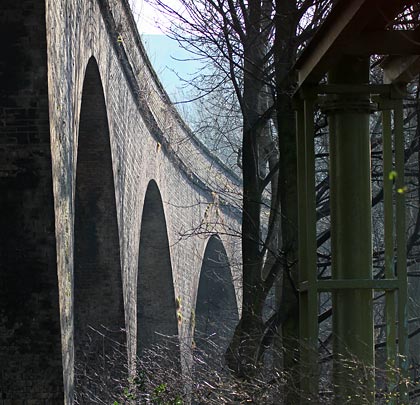
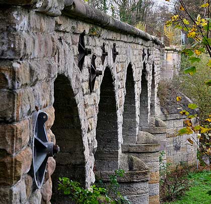
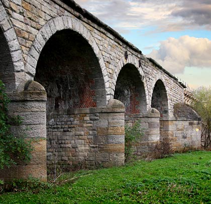
Willow Burn Viaduct
A classic viaduct: Willow Burn's stone piers and sprandels contrast with its brick arch soffits.
(Photos 8-10 Mick Nicholson Collection)
Grade II listed, the seven-arch Willow Burn Viaduct is built of rock-faced stone with corniced piers and rusticated voussoirs. Two broad flat pilasters are found at each end of structure. The arch soffits are in red brick.
Built for the York, Newcastle & Berwick Railway in 1849, this neat double-track viaduct overlooks open countryside and now carries a footpath. Owned by British Railways Board (Residuary), it benefitted from a repair and waterproofing scheme in 2007, 42 years after rail traffic last used it.
May 2011
Willow Burn Viaduct
Whitacre Mill (Deighton) Viaduct
The northernmost arch crosses the Huddersfield Broad Canal.
Opened by the London & North Western Railway on 7th October 1867, the 4½-mile branch connecting Deighton with Kirkburton was built with the intention of it forming part of a through route to the Barnsley coalfield, but this was thwarted by the withdrawal of other proposed lines. As a result, although sufficient land was acquired for two, only one running line was laid.
The branch mostly handled goods traffic; passenger services lasted only until July 1930. Most of the line was closed on 5th April 1965, the exception being a mile-long spur to the British Dyes chemical works where sidings were provided. This saw its last train on 1st February 1971 and was declared non-operational in December.
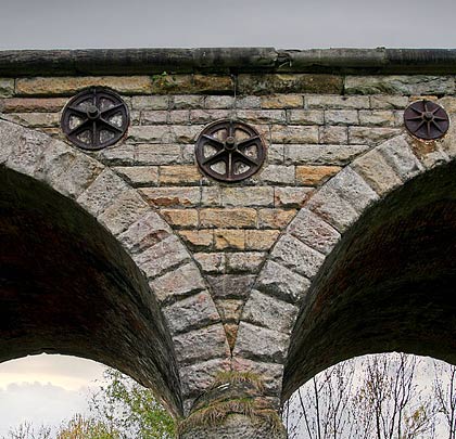
Work on the branch got underway in March 1865. The principal engineering features were two viaducts – one of six arches over Beldon Brook and another crossing the Huddersfield Broad Canal, a drain and the River Colne at Deighton. Built on a curve of 22 chains radius, the latter consists of seven arches, each spanning 64 feet and with a rise of 21 feet 4 inches. End to end, it extends for about 177 yards.
By the middle of February 1866, four of the arches were close to completion, the timber centring having been removed from the two most northerly spans eight weeks earlier. A slight subsidence was subsequently noticed in span 2 but this was not thought to be serious. However, at around 2 o’clock on the morning of Thursday 15th February, wet weather and frost caused it to collapse, bringing down with it the adjacent arch over the canal. Sixty men were set to work clearing away the debris, the cost of the damage estimated at more than £600. The 12-foot high pier supporting the third arch remained firm but was propped with timber beams as a precaution.
Messrs Eckersley & Bayliss acted as the branch’s main contractor although the viaduct construction was sub-let to Messrs Sigley, Miles & Haynes. Its predominant material is blue engineering brick although the arch faces appear red or yellow. Above the piers, measuring 8 feet 6 inches wide, are stone imposts from which the arches spring. The parapets feature masonry copings; no provision is made within them for trackworker refuges. The deck is 24 feet wide, tapering outwards slightly at its south end.
Identified as structure KBN/3, the viaduct was the focus of extensive remedial works in 2001, carried out by its owner British Railways Board (Residuary). In October 2007, a Kirklees Council study identified the structure as forming part of a possible greenway between Kirkheaton and Leeds Road at Deighton, but this has not yet been progressed.
Sept 2009
Whitacre Mill (Deighton) Viaduct
Wheatley Viaduct
Built for the Halifax High Level Railway, Wheatley Viaduct formed part of a half-mile long curve of about 23 chains in radius.
(Photo 9 © GoogleEarth)
Conceived as part of a grander scheme in 1883, the Halifax High Level and North & South Junction Railway – abbreviated in 1892 to the Halifax High Level Railway – extended for a little over three miles, leaving the Halifax-Queensbury line at Holmfield and terminating at St Pauls Station. Construction got underway late in 1887, requiring a workforce of between 1,100-1,200 men employed by the contractor, Messrs Baker of Bradford.
Two substantial structures were required towards the northern end – a viaduct of ten arches and an 819-yard tunnel, both at Wheatley. The former was approaching completion by August 1889 when the half-yearly shareholders meeting was told that its arches had been turned and its masonry was built except for the parapets.
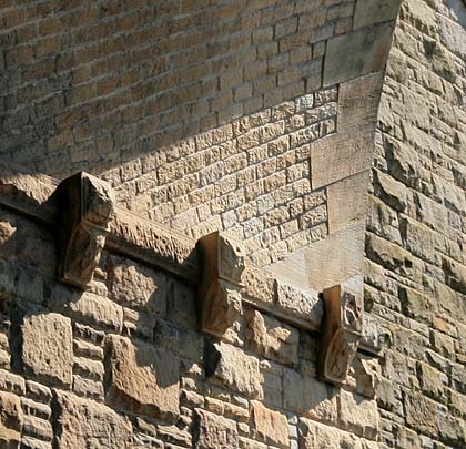
Wheatley Viaduct is an imposing addition to the landscape, reaching a height of 100 feet to look out over adjacent housing. It extends for almost 200 yards, curving to the east throughout on a radius of about 23 chains.
Whilst the arches are brick, the remainder of a structure is stone. Included are carefully masoned voussoirs but, behind these, several sections of brickwork have been lost resulting in some spans being fenced off beneath. Refuges are built out above every other pier, with the two sides’ refuges being offset by one pier. The stone support blocks for the arch centring are still in situ on each pier face.
The inaugural passenger service over the Halifax High Level ran on Thursday 4th September 1890 although goods had been carried as far as Pellon – the only intermediate station – since 1st August. Running northbound, the train stopped at the tunnel’s western entrance to allow Mrs Booth, the Mayoress, to unlock the gates with a silver key. There was much rejoicing. This was, however, short-lived as the passenger service linking the higher and lower parts of Halifax lasted only 26 years, ending on 1st January 1917. Goods trains continued to shuttle back and forth until 25th June 1960.
March 2013
Wheatley Viaduct
Wharfe Viaduct
At the north side, five masonry approach spans carried the railway over the Wharfe's flood plain towards the river crossing.
(Photo 7 © Andrew King)
On 21st July 1845, a Parliamentary Act was passed authorising George Hudson’s York & North Midland Railway to construct a 18½-mile line connecting Church Fenton with Harrogate. The route was staked out two months later and opened as far as Spofforth on 10th August 1847. The remainder of the line into Harrogate involved major engineering works including the 31-arch Crimple (Valley) Viaduct and two tunnels totalling 1,240 yards. It was completed on 20th July 1848. The whole venture cost the company £607,000. The route was unfavourably graded, with one 5½-mile section rising continuously at 1:101 or steeper.
Three miles south-east of Wetherby, the line crossed the River Wharfe on a 162-yard viaduct, constructed in three distinct parts: five-arch masonry structures on either bank connected by two fabricated steel plate girder spans across the water. The latter are later replacements.
Forming the approach viaducts are limestone blocks with rock-faced voussoirs and brick arch barrels. Ashlar is used for the cutwaters and string course. The parapets have mostly been lost except on the west side of the northern structure.
On each bank are abutments with domed cutwaters. Their river-facing sides feature seats which braced the four cast-iron arches that originally formed each of the two river spans. This arrangement is repeated on the pier standing in the water. The replacement steel girders were narrower than their predecessors so walkways were built out on both sides, supported by triangular brackets to which handrails were also attached.
The section of line to the south of Wetherby – crossing the viaduct – survived until 4th April 1966. Today it is Grade II listed but its condition is generally poor, with cracks apparent in the piers, spandrels and arches. Remedial work has been carried out, as evidenced by the many pattress plates and tie bars installed.
Plans were lodged in 2005 to open a footpath across the structure as part of the redevelopment of a former paper mill for office space and housing. Around £1 million would have been invested in repair work to the viaduct. Planning consent for the scheme was granted in 2011 but this has not yet been exercised.
December 2014
Wharfe Viaduct
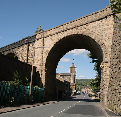
West Vale Viaduct
The masons demonstrated their prowess.
With 13 sandstone arches and a curve at its northern end, West Vale Viaduct on the short Stainland branch is now protected by a Grade II listing. Sustrans recently took responsibility for it and, in partnership with Calderdale Council, was carrying out £125,000 worth of work on the structure with a view to opening it as part of Route 66 on the National Cycle Network. However local opposition forced the scheme to be abandoned part way through.
October 2013
West Vale Viaduct
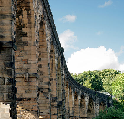
Westfield (Avon) Viaduct
Westfield's south elevation, showing its 12 main spans.
The coal and iron pits around Airdrie spawned three railways as servants, stretching from Kirkintilloch to Linlithgow. These came together in 1848 to form the Monkland Railways. In July 1853 the company obtained Parliamentary powers to connect the former Slamannan line at Blackston Junction to Bathgate and Armadale.
The route’s most striking structure was a viaduct featuring 12 main spans, each of 47 feet, over the River Avon’s wide valley near Westfield. In addition, pairs of smaller arches were accommodated into the abutments. Standing 60 feet high, the single-tracker plots its course for a little over 220 yards. At its south-eastern end is an approach embankment of about 130 yards.
Except for the brick arches, the viaduct is built in stone, the first of which was laid on 11th August 1854. An inaugural coal train traversed the branch on 11th June 1855 although passenger services did not receive the Board of Trade’s approval for another 13 months. The route over the viaduct closed on 28th December 1964.
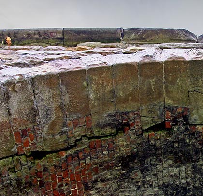
British Railways Board (Residuary) look after the structure, number BKN/10 on its inventory. Despite receiving a Grade B listing in November 1974, parts of it are in poor condition, particularly on the north-east elevation. All but two of the main spans are strengthened with tie bars – three per arch – passing both through the spandrels and beneath the barrel. These are held in place with long iron plates keyed into the masonry. Above one of the arches, a sapling has taken root causing considerable damage to the adjacent voussoirs. Many patch repairs have been carried out in brick, owing to widespread loss of the stone faces.
The viaduct’s slender piers broaden slightly at their feet and all are topped with two-stage bedstones. Buttresses are incorporated between the main and smaller arches, forming generous refuges at deck level, but there are no refuges above any of the piers.
Despite its failings, Westfield Viaduct is a fine and attractive addition to the local landscape.
July 2008
Westfield (Avon) Viaduct
Warmsworth bridge
Crossing the River Don, the bridge consists of a 112ft 6inch centre span, with side spans of just over 59 feet.
(Photo 10 © RCAHMS (Aerial Photography Collection))
In 1909 the Hull & Barnsley Railway sought Parliamentary approval to drive a line southwards from Gowdall to Braithwell Junction, a distance of almost 22 miles, with the intention of greatly improving the movement of coal traffic around South Yorkshire. Initially the plan faced widespread opposition from other railway companies but the issues were resolved and the line was eventually built jointly with the Great Central, to a design by Richard Pawley, the H&B’s chief engineer.
Work got underway in January 1911 following the award of a contract to Messrs Logan & Hemingway of Doncaster. G B Barton and T Clark acted as resident engineers. Progress was delayed by the First World War but mineral and goods traffic began traversing the route on 1st May 1916. This was a heavily engineered railway, demanding 70 bridges and large culverts, as well as 2,243,000 cubic yards of excavation; this material, along with 194,000 cubic yards of colliery waste, was used to form the embankments. The two largest structures were a lifting bridge over the Knottingley & Goole Canal and a fixed bridge across the River Don at Warmsworth.
The latter’s steelwork – consisting of a centre span of 112 feet 6 inches and two side spans of 59 feet 3⅞ inches – was manufactured and erected by Eastwood Swingler and Co of Derby. The distance between the main girders measured 26 feet 6 inches, allowing for two tracks. The clear headway above water level to the underside of the bridge was 38 feet 6 inches.
The spans are supported by two piers comprising pairs of cylinders, each about 56 feet high and 28 feet 6 inches between centres. These are filled with Portland cement. The portion below ground was built in cast iron, ranging from 10 feet in a diameter at the base to 7 feet. Above ground, the cylinder has a diameter of 7 feet and consists of steel plates and angles, with an ornamental cast iron cap at the top. Each pair of cylinders is braced with a strong steel lattice girder. The cast iron sections were sunk under air pressure, the steel portions having been sent to site pre-riveted and then bolted to the cast iron parts.
The centre span’s bowstring girders are 112 feet long by 12 feet 10 inches deep at their centres, reducing to 6 feet 10 inches at the ends. They were sent from the manufacturer’s works at Derby in component form and assembled on specially constructed steel bogies in a siding close to the bridge. Thereafter they were pulled onto a temporary timber structure – alongside the railway bridge but at a lower level – used by the contractors for construction purposes. From this they were jacked up to the correct height and slewed into position.
The girders for the side spans are Linville type, 62 feet ⅞ inch long by 7 feet 1 inch deep and arrived from the works riveted up. All the spans have fixed and expansion bearings. The bridge deck is composed of single web cross girders and ⅜-inch flat plates, with a walkway provided along the side of each main girder. The total weight of steel, cast iron and cast steel amounts to 600 tons.
The abutments and wing walls are built of blue brick in cement, faced with Brindley brick, with masonry and blue-brick capping, whilst the bedstones carrying the main girders are granite.
Closure came to the route in piecemeal form between 1958 and 1979, although regular traffic at the southern end of line (Braithwell Junction-Warmsworth Junction) had ceased in 1942, after which it was used for wagon storage. The section over the bridge continued to serve Yorkshire Main Colliery until 3rd February 1969. For some years the bridge was used to carry a conveyor belt over the River Don but was reborn for public use when it was incorporated into the Doncaster spur of the Trans Pennine Trail in 2001.
July 2013