


Presthope Tunnel
Presthope Tunnel
The cross-country route between Buildwas in Shropshire and Marsh Farm Junction, north of Craven Arms, opened in phases between 1862 and 1867.
The first three miles, built by the Much Wenlock & Severn Junction Railway, branched off the Severn Valley line to reach Much Wenlock on 1st February 1862. Two years later, the Wenlock Railway bridged a short gap between Buildwas and the Great Western network at Coalbrookdale, making through running possible from Wellington and the West Midlands. The same company also pushed the branch onwards from Much Wenlock to Presthope, opening on 5th December 1864. The remaining 11 miles south-westwards were completed in 1867. Charged with the engineering work was John Fowler whilst Thomas Brassey and William Field were successful in tendering to deliver it.
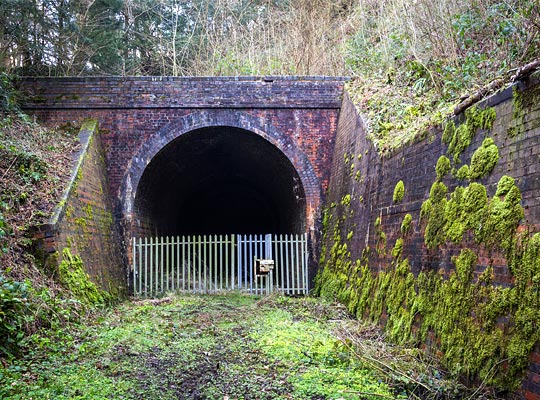
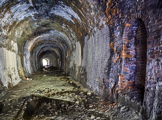
One of Fowler’s most difficult challenges was to push the railway through Wenlock Edge, a 19-mile limestone escarpment which the line generally followed. He didn’t do this to achieve the best alignment; his hand had been forced by resistance from local landowners. And so Presthope Tunnel was driven, extending for 207 yards and following an S-shaped course.
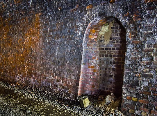
From the west, the line curved southwards on its approach to the tunnel, the radius being about 24 chains. As the land drops away to the north, the slope on the south side becomes particularly steep, requiring a lengthy retaining wall to ensure its stability. This connects with a wing wall which rises to meet the top of the parapet. A smaller wing wall is provided on the opposite side. The portal itself is brick-built and exhibits a four-ring thick arch face. A foot or so beyond the entrance at the south-side haunch is a collection of three telegraph wire brackets.
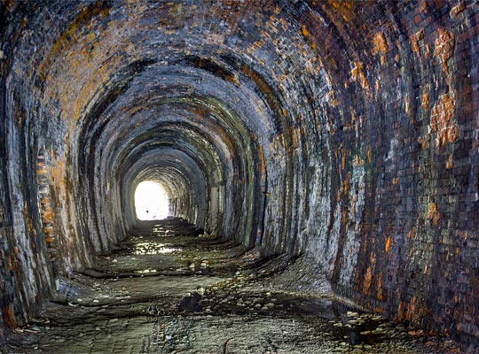
The curve continues into the tunnel, before straightening near the midpoint. Towards the east end, a northerly curve is introduced, the radius being in the order of 22 chains.
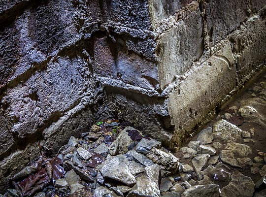
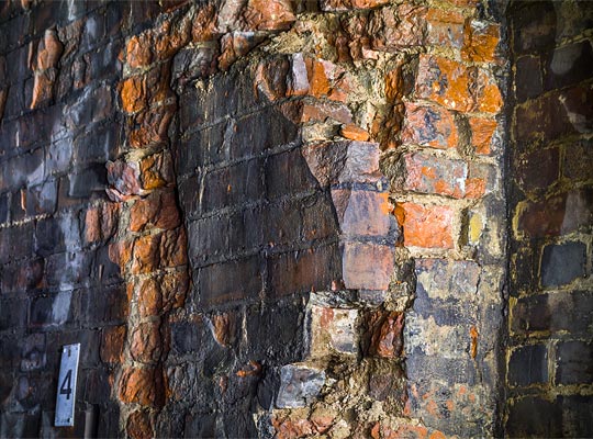
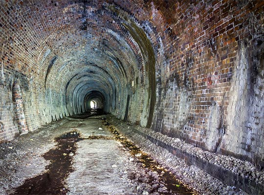
Any remaining original brickwork is in poor condition, being extensively spalled. The root cause is the considerable water ingress which afflicts the tunnel. Attempts have been made to manage this through the installation of numerous weep pipes which outflow from the south sidewall. The lining is better where patch repairs have been carried out.
Variably proportioned refuges are provided at regular intervals. Adjacent to one of them, a small section of the sidewall’s outer ring – perhaps 1m2 – is close to collapsing due to severe water damage. Several bricks have fallen from this refuge’s arch whilst another has lost brickwork at its base.
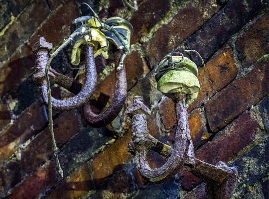
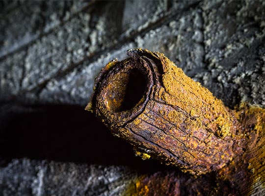
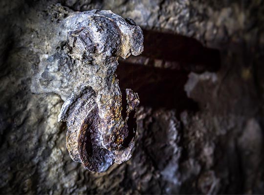
Several timber signage mounts are still affixed to the north sidewall, as is a signalling pulley and further telegraph wire brackets. On the opposite side at about springing level is a row of rusting cable hangers.
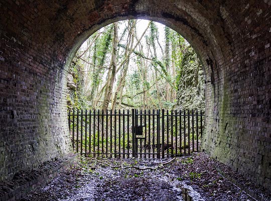
Towards the tunnel’s eastern end, brick ledges are visible at the toe of both sidewalls – possible evidence of an invert. Looking into the daylight, the approach cutting is choked by trees and vegetation. Immediately in front of the portal, the cutting is flanked by vertical rock faces for a short distance.
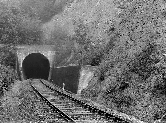
The through route closed on 31st December 1951 when all services were withdrawn from the section south of Longville. Passenger trains continued to serve Much Wenlock whilst stations beyond were still visited by a daily pick-up goods – passing through the tunnel – until 1960. The passenger timetable was completely withdrawn in July 1962 and the line succumbed to full closure on 30th November 1963.
Wenlock Edge was designated as a Site of Special Scientific Interest in 1954 and includes a small area around the western end of the tunnel. In 2012, the National Trust and Shropshire County Council looked at linking up bridleways at either end by establishing a route through the tunnel. To date, this has not been taken forward.
Click here to visit the British Geological Society’s photo archive.

 June 2016