


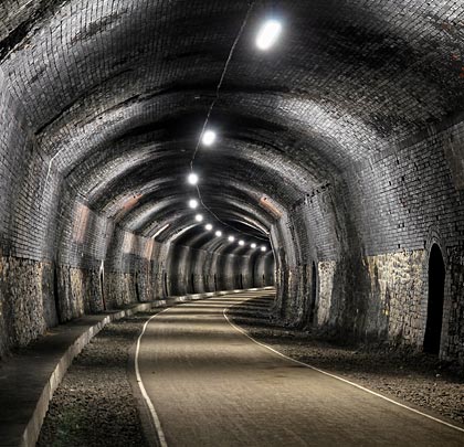
Headstone Tunnel
Headstone Tunnel
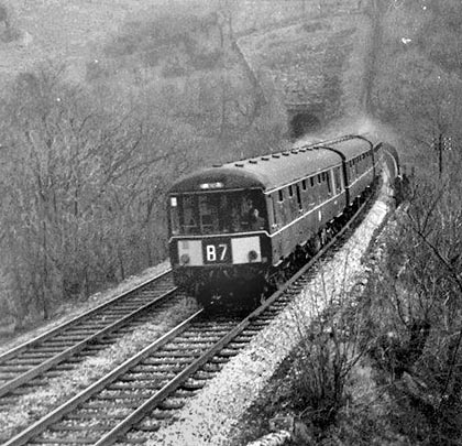
30th May 1863 saw the opening of an exceptional section of railway, eventually forming part of a main line link between London and Manchester. Built by the Midland, it cut a route through the limestone landscape of Derbyshire’s Wye Valley between Hassop and Buxton, demanding eight tunnels totalling 2,426 yards, two major viaducts and a number of smaller ones in the space of just 11 miles. But the audacity and investment did not live long. Barely a century after it opened, most of the route became an unlikely victim of the Beeching-era cuts, officially closing on 1st July 1968.
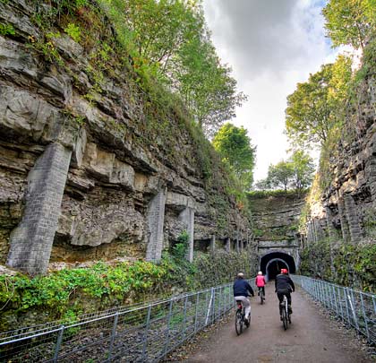
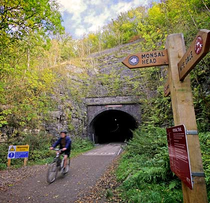
In 1981, the Peak District National Park Authority concluded lengthy negotiations with British Rail to secure the trackbed. Along it was laid the Monsal Trail – a nine-mile path linking Blackwell Mill Junction, east of Buxton, with a bridge over Coombs Road on the Matlock side of Bakewell. Since the summer of 2011, four of the tunnels – which had previously been closed for safety reasons – have been opened up for walkers, cyclists and horse riders to use, creating an easy linear connection between the Trail’s two ends.
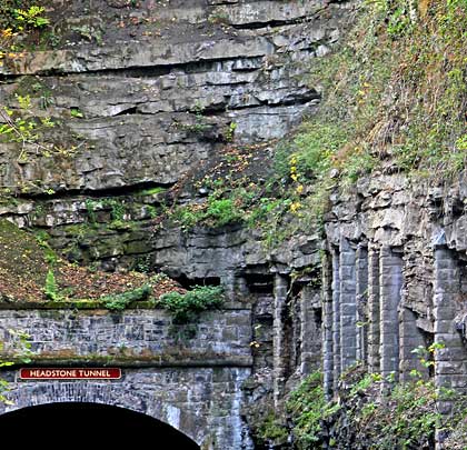
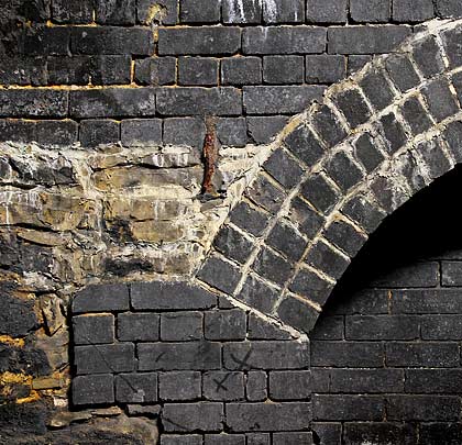
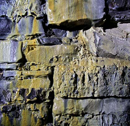
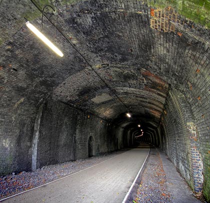
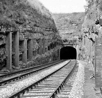
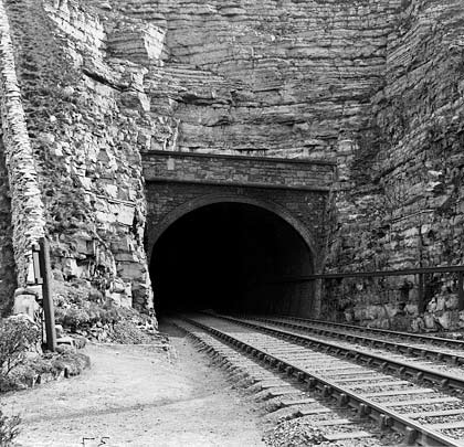
The easternmost tunnel – Headstone – is the longest at 533 yards. Its outstanding eastern approach cutting has near-vertical sides and the special designation of a geological SSSI thanks to its distinctive rock strata. Some outcrops have been supported with masonry or brick pillars. Loose material and much of the vegetation have been removed as part of the conversion for pedestrians and cyclists. They are afforded protection from falling rocks by a steel-framed canopy inserted into the tunnel entrance.
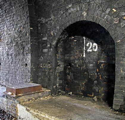
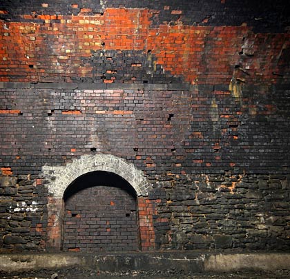
The eastern half of the tunnel is straight, falling on a gradient of 1:107 to the west, whilst the other incorporates a curve to the north of 39 chains in radius. The predominant lining material is engineering brick although patch repairs – some of them extensive – have been carried out in both red brick and masonry. The tunnel’s segmental roof arch is supported on side walls which curve inwards slightly.
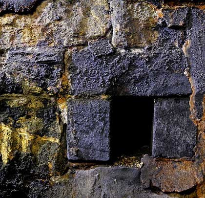
Refuges of inconsistent sizes are provided in both walls and three changes of section occur – one close to each entrance and a third around 100 yards from the western end. A concrete-encased water main is located at the foot of the south-side wall. The lining features numerous holes – each around 10x15cm – either to aid drainage or support maintenance platforms. Whilst generally dry, small deposits of calcite are found in places.
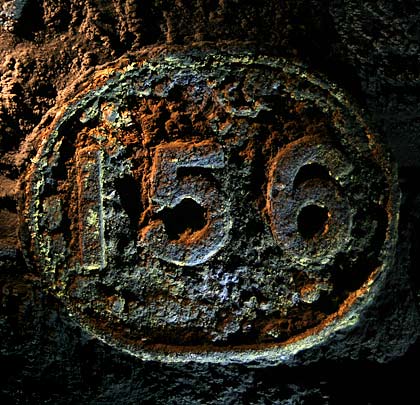
The route’s 156 milepost was located within the tunnel but the plate which marked it was removed as part of the Trail conversion. The bore is now lit and a cycle-friendly surface has been laid.
The western approach cutting is much shorter as the side of the Wye Valley rises steeply. Just beyond the portal is the five-arch Monsal Dale Viaduct which was immortalised in a Midland Railway poster.

 April 2012