Devonshire Tunnel
Devonshire Tunnel
![Overlooked by a telegraph pole, the masonry portal at the south end is substantially covered in ivy.](http://www.forgottenrelics.org/wp-content/uploads/2023/03/image1-110.jpg)
![Inside, the tunnel is home to a mass of clutter including tables, chairs and a pile of beer bottles.](http://www.forgottenrelics.org/wp-content/uploads/2023/03/image2-110.jpg)
![A drain - still functioning - is buried beneath the Up-side wall.](http://www.forgottenrelics.org/wp-content/uploads/2023/03/image3-110.jpg)
![Refuges feature on both sides, mostly of differing dimensions.](http://www.forgottenrelics.org/wp-content/uploads/2023/03/image4-109.jpg)
![Devonshire features a curve of half-a-mile in radius except for short straight sections at either end.](http://www.forgottenrelics.org/wp-content/uploads/2023/03/image5-109.jpg)
![Near the centre, a section of bullhead rail stands with its back to the wall. It was once the proud holder of the 24 milepost.](http://www.forgottenrelics.org/wp-content/uploads/2023/03/image6-108.jpg)
![A cable troughing route is found at the foot of the Down-side wall.](http://www.forgottenrelics.org/wp-content/uploads/2023/03/image7-106.jpg)
![There are many holes in the lining, probably created to accommodate timber staging used for repair work.](http://www.forgottenrelics.org/wp-content/uploads/2023/03/image8-94.jpg)
![Despite the track being lifted in the late Sixties, indentations from the sleepers are still apparent.](http://www.forgottenrelics.org/wp-content/uploads/2023/03/image9-80.jpg)
![The tunnel is very sooty but, in places, a channel of clean stone has been blasted at the crown of the arch.](http://www.forgottenrelics.org/wp-content/uploads/2023/03/image10-64.jpg)
![Close to the north end, a trickle of running water penetrates the lining.](http://www.forgottenrelics.org/wp-content/uploads/2023/03/image11-47.jpg)
![Whilst predominently dry, water ingress creates a wet and partly calcified section near the Bath portal.](http://www.forgottenrelics.org/wp-content/uploads/2023/03/image12-34.jpg)
![When its approach cutting was infilled in 1973, entry at the northern end was maintained through provision of an access shaft.](http://www.forgottenrelics.org/wp-content/uploads/2023/03/image13-27.jpg)
![Now breathing again, the recently excavated north portal awaits the removal of its blockwall and shaft.](http://www.forgottenrelics.org/wp-content/uploads/2023/03/image14-20.jpg)
![The extreme tightness of Devonshire's structure gauge is illustrated by the emergence of this Bath-bound service.](http://www.forgottenrelics.org/wp-content/uploads/2023/03/image15-11.jpg)
![Captured after closure, the northern end of the tunnel exhibits the same problem with water ingress as is apparent today.](http://www.forgottenrelics.org/wp-content/uploads/2023/03/image16-8.jpg)
![](http://www.forgottenrelics.org/wp-content/uploads/2023/03/image1-110.jpg)
![](http://www.forgottenrelics.org/wp-content/uploads/2023/03/image2-110.jpg)
![](http://www.forgottenrelics.org/wp-content/uploads/2023/03/image3-110.jpg)
![](http://www.forgottenrelics.org/wp-content/uploads/2023/03/image4-109.jpg)
![](http://www.forgottenrelics.org/wp-content/uploads/2023/03/image5-109.jpg)
![](http://www.forgottenrelics.org/wp-content/uploads/2023/03/image6-108.jpg)
![](http://www.forgottenrelics.org/wp-content/uploads/2023/03/image7-106.jpg)
![](http://www.forgottenrelics.org/wp-content/uploads/2023/03/image8-94.jpg)
![](http://www.forgottenrelics.org/wp-content/uploads/2023/03/image9-80.jpg)
![](http://www.forgottenrelics.org/wp-content/uploads/2023/03/image10-64.jpg)
![](http://www.forgottenrelics.org/wp-content/uploads/2023/03/image11-47.jpg)
![](http://www.forgottenrelics.org/wp-content/uploads/2023/03/image12-34.jpg)
![](http://www.forgottenrelics.org/wp-content/uploads/2023/03/image13-27.jpg)
![](http://www.forgottenrelics.org/wp-content/uploads/2023/03/image14-20.jpg)
![](http://www.forgottenrelics.org/wp-content/uploads/2023/03/image15-11.jpg)
![](http://www.forgottenrelics.org/wp-content/uploads/2023/03/image16-8.jpg)
In 1870, plans were drawn up to build an extension of the Somerset & Dorset Railway, connecting Evercreech Junction with Bath over the Mendip hills where a summit would be reached 811 feet above sea level. Its engineers fought a constant battle with the topography – the railway having to create its own level with cuttings, tunnels, embankments and viaducts – one big and several small – for the final three miles into Bath. Work to built it got underway in 1872.
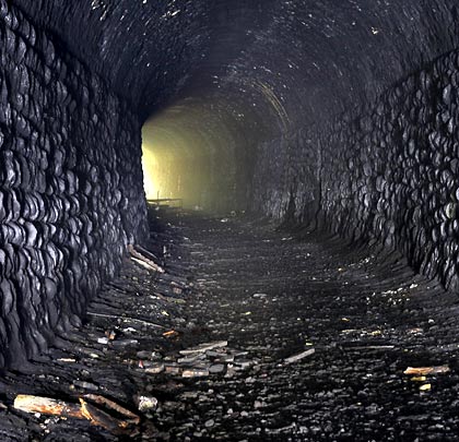
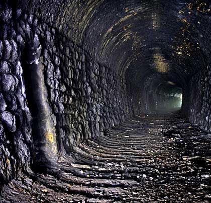
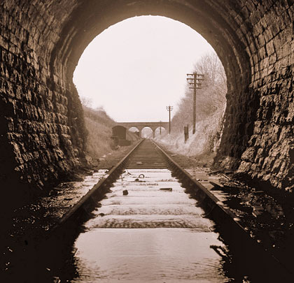
Having left behind the mile-long Combe Down Tunnel, the line descended on a falling gradient of 1:50 as it penetrated the single-track Devonshire Tunnel, structure number SAD/10. South of the city centre, this lies on an approximate east-west alignment but incorporates a curve to the north of half-a-mile in radius over much of its length. Although planned at 290 yards with substantial approach cuttings, the tunnel as built is 447 yards in length. This possibly explains the short straight sections at either end – the curve representing the extent of the structure as it was initially conceived. The bore’s width varies from 11’6″-13’7″ whilst the crown of the arch is between 14’9″-18’0″ above the invert. Its centre is overlain with limestones of Inferior Oolite, running westwards into the Midford Sands.
Progress with construction was swift. A year into the job, a heading had been driven throughout and the masonry lining completed over a distance of 150 yards. The company expressed satisfaction that the work was “being executed substantially and well”. There are no records of any construction shafts, although the local rumour mill does talk of one.
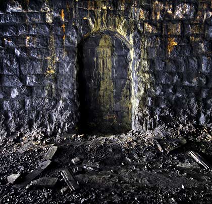
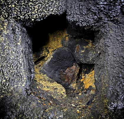
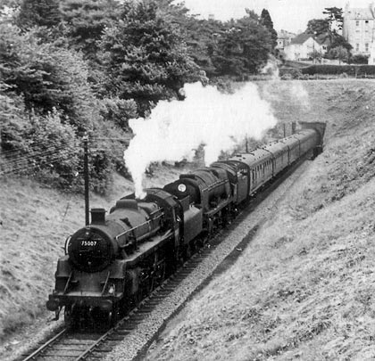
The first commercial services trundled between Devonshire’s portals on 20th July 1874, passing the 24 milepost at its centre. Such was the challenge of the climb out of Bath, goods trains had to be assisted by banking engines through the bore. Its structure gauge was notoriously tight, with clearance of less than one foot for some traffic; this conspired with the gradient to produce wretched conditions for anyone working inside, particularly when a Down train was encountered. Located in its walls are 23 refuges of assorted sizes, built to provide positions of safety.
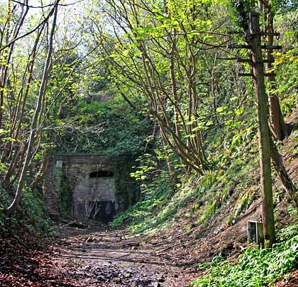
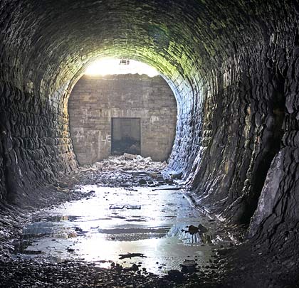
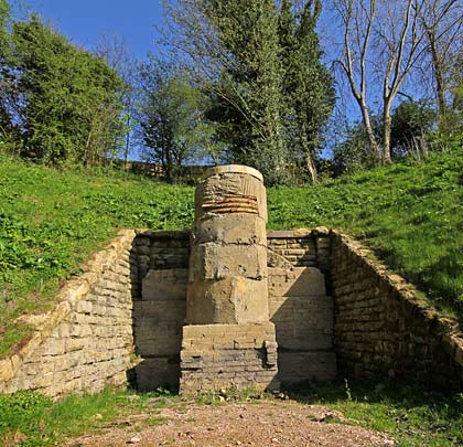
7th March 1966 witnessed the last train escape from Devonshire Tunnel. Seven years later, the trackbed into the city was claimed to create Bath’s ‘Linear Park’, resulting in the northern approach cutting and portal being buried with material from a nearby embankment. An access shaft was established for inspection purposes but this was permanently sealed some time later. In 2010, as part of work on the Two Tunnels Greenway, the portal was exhumed and the tunnel will be reopened as part of a shared path during 2011. To that end, it is now owned by Sustrans, having previously been under the stewardship of British Railways Board (Residuary).
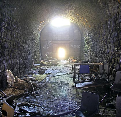
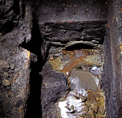
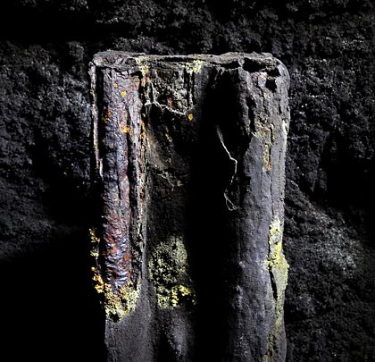
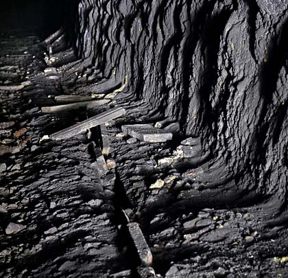
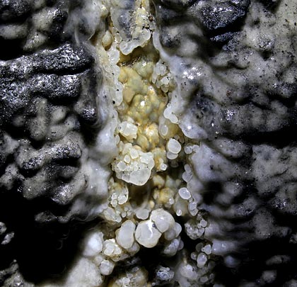
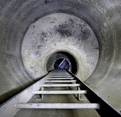
Inside, the tunnel is dry except for a section towards the northern end where running water enters through the lining. Weep holes are provided to relieve the build up of pressure, resulting in some standing water. This has partly calcified. Buried at the foot of the Up-side wall is a still-functioning drain which emerges into view as it passes in front of one refuge. The other side accommodates a narrow cable troughing route, now dilipidated.
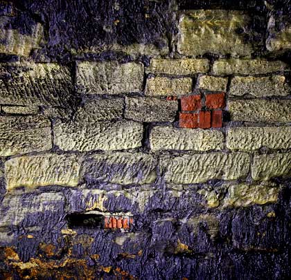
Unsurprisingly, the masonry is encrusted with thick soot although a channel of clean Bath stone is occasionally visible at the crown of the arch. The lining features many holes, cut presumably to support staging platforms used for maintenance work. Some spot repairs in brick are apparent.
The southern end of the tunnel, close to its only current access, contains the detritus brought when illegal gatherings were held during the Nineties. This includes tables, chairs and a substantial collection of empty beer bottles.