


Crawleyside Tunnel
Crawleyside Tunnel
Plans for what became the Stanhope & Tyne Railway developed in the early 1830s with the intention of cheaply transporting to market the considerable mineral reserves found in the hills of County Durham. The route would connect limestone quarries near Stanhope – which supplied raw materials for iron ore smelting – and coal mines at West Consett and Medomsley.
The original route was formalised under a deed dating from January 1832, but this met the River Tyne upstream of Newcastle, limiting the size of vessels that could reach it. Instead the decision was taken to construct an independent railway to South Shields, extending 34 miles and costing around £200,000. Thomas Elliot Harrison was appointed as the company’s engineer; for a fee of £1,000, Robert Stephenson’s expertise was secured as consulting engineer.
Rather than applying for Parliamentary authority to construct the line, wayleaves were negotiated with individual landowners. Although cheaper on the face of it, this approach resulted in extortionate annual charges averaging more than £280 per mile, eventually contributing to the S&TR’s downfall.
Work got underway near Stanhope in July 1832; here the local topography proved particularly challenging. From the quarry sidings, the railway would head north up the hill by mean of rope-worked inclines. The first was 934 yards in length, featuring gradients of 1:8 and 1:12. At the top was the Crawley engine where the ropes were changed and wagons then hauled up to the Weatherhill engine, over a mile away. The gradients there were 1:21 and 1:13. Thereafter, wagons were drawn up a third incline at 1:57 to the summit level at Parkhead, 1,474 feet above sea level. This was the highest point on any railway in England.
Each January, the whole line closed for a week to allow the inclines’ ropes to be changed and their machinery inspected. This coincided with colliery closures for similar reasons. Locomotive working on the sections above Crawley was introduced in 1847.
Traffic started rolling on the 15¼-mile section from Stanhope to Annfield on 15th May 1834. A man and a boy lost their lives when the coupling broke on a set of wagons carrying 40-50 people, resulting in it running away down the Weatherhill incline and being smashed to pieces in a siding at the bottom. The eastern end of the line opened on 10th September. Passengers were carried from April 1835, prompting landowners to levy even higher charges for the wayleaves.
The company’s proprietors had forecast considerable profits, however its finances were mismanaged and traffic never reached expected levels. By the end of 1840, the company was unable to pay its debts. The company’s authorised capital was £150,000, but loans valued at £440,000 had been obtained, violating the terms of its deeds.
On 29th December, an extraordinary general meeting was held at which it was decided to promote a statutory company – with capital of £440,000 – to take over the railway. And so, on 5th February 1841, the company was dissolved and both its assets and debts transferred to a new company, the Pontop & South Shields Railway.
The limestone quarries at Stanhope, together with the section of line heading north to Consett, were sold to the Derwent Iron Company. To improve connectivity, it constructed a spur line between Waskerley and Crook where it joined the Stockton & Darlington (S&DR). The railway side of its operation was then transferred to the S&DR, opening on 16th May 1845.
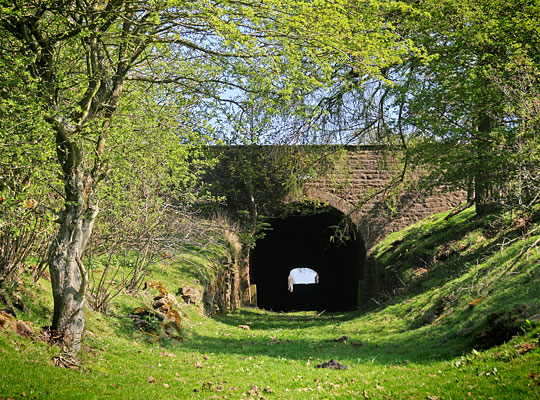
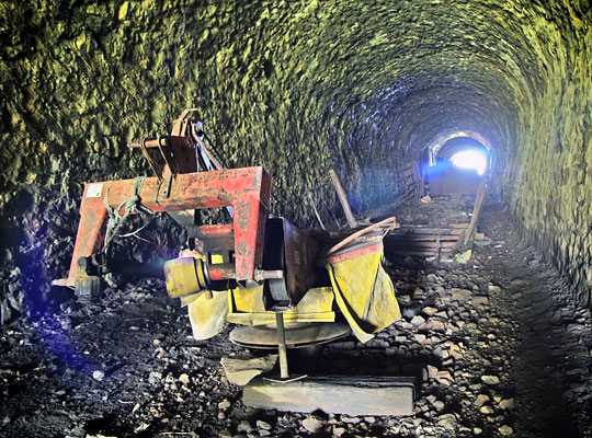
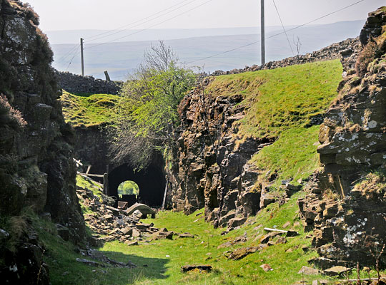
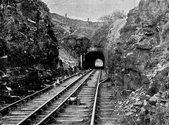
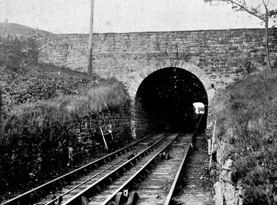
Part way up the Crawley incline, the railway passed through Crawleyside (aka Hog Hill) Tunnel, 121 yards in length and assigned the structure number WAY/2. It carries what is now the B6278. Although only wide enough for a single line, two interlaced tracks were installed in later years.
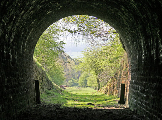
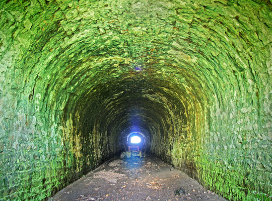
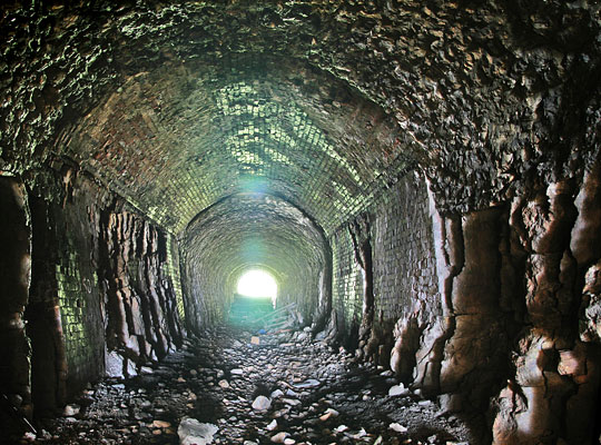
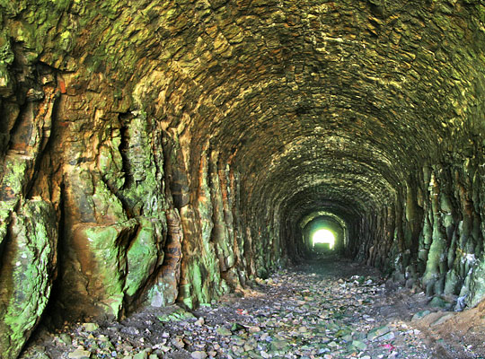
The southern half of the bore is fully lined in stone. Directly beneath the road, a brick lining has been inserted to support the roof, comprising a segmental arch with vertical sidewalls. Only an arch is provided through the northern section, generally springing off the exposed rock. Rubble and detritus litter the floor, and an assortment of old farm machinery is stored inside.
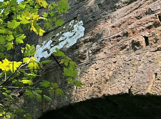
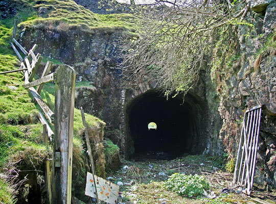
The Crawley incline closed in November 1949. Since then both portals have been assigned Grade II listed status. At the south end is a neat sandstone headwall incorporating a date stone, above the arch, inscribed 1833. Vertical retaining walls, reaching five feet in height at the entrance, hold back the cutting slopes.
At the other end, the line emerged into a cutting with a vertical rock face on its west side. No built headwall is provided, although the arch ring face is visible. Stone sidewalls extend a few yards into the tunnel.

 Sept 2017