


Castle Hill Tunnel
Castle Hill Tunnel
29th July 1864 saw Royal Assent for a 43-mile cross-country line that would connect the Devon town of Barnstaple with the Bristol & Exeter Railway at Norton Fitzwarren. Appointed as its engineer was the fabulously named Eugenius Birch, although he was replaced by Richard Hassard in 1870 as work on the easternmost seven miles neared its completion. Trains first ran over this section on 8th June 1871 – building work having been protracted, as one newspaper put it, by “the great [financial] panic of 1866 and all the wreck and ruin which attended it”.
Assigned to contractor Mr J L Reed, the remainder of the route involved heavy engineering, with two substantial viaducts and four tunnels totalling more than 1,000 yards in length. Gradients were stiff, exceeding 1:60 in places. Work was completed in 1873, opening on 1st November. The cost was considerable, reaching £20,000 per mile; around 1,750,000 cubic yards of excavation was demanded and 40,000 cubic yards of masonry erected.
The single track was converted to standard gauge on 18th May 1881, having closed just four days earlier to enable the required track work to be undertaken. In 1887, a connection was made to the London & South Western Railway at Barnstaple, allowing through services to Ilfracombe. These had to reverse at the Devon & Somerset terminus until an avoiding line was added in 1905. Although the route was heavily trafficked in the period between the wars, closure came to the D&S on 1st October 1966.
The station at South Molton was one of the biggest, with a station master’s house, waiting rooms, booking hall and offices on the Down (westbound) platform. Also sited here was a signal box, good yard and the final passing loop before Barnstaple. Hence there was an Up platform with modest waiting shelter.
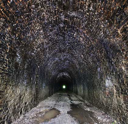
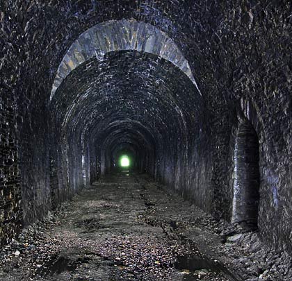
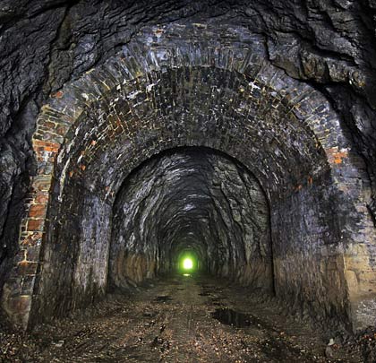
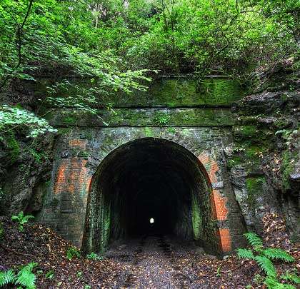
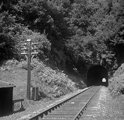
Heading west, the line curved over a substantial embankment – passing a platelayers’ cabin and telegraph pole – before entering a tunnel of 319 yards beneath Bremridge Woods. The 1889 Ordnance Survey map identifies it as Bremridge Tunnel although it is named Castle Hill on subsequent editions.
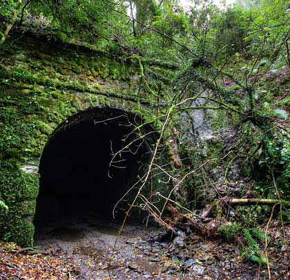
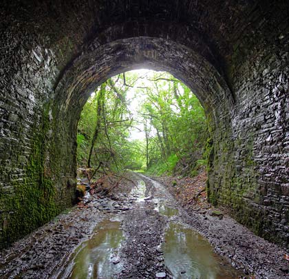
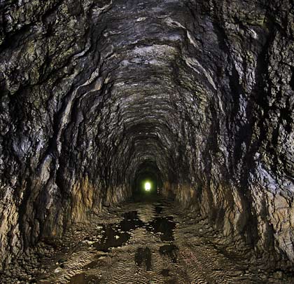
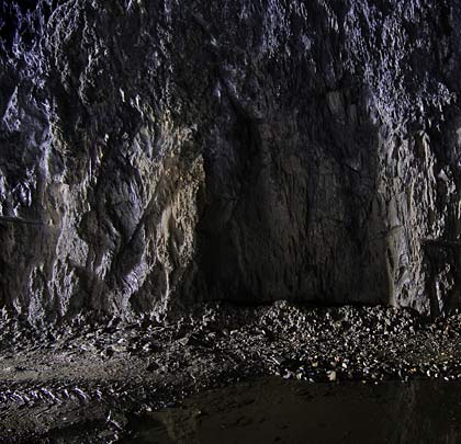
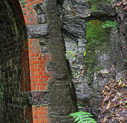
At the end of its short approach cutting is the modest south portal – masonry-built with a high headwall that features copings and two string courses. Later repairs have been carried out in red brick. After ten feet, the stonework ends to reveal an unlined section of tunnel, cut through the Pilton mudstone formation. The profile suggests that a top heading was driven – this would be used to determine roof conditions and provide additional ventilation during the construction works.
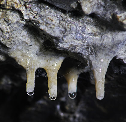
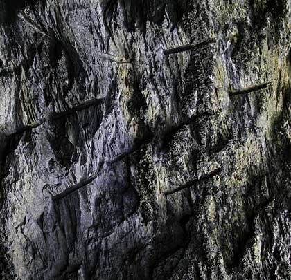
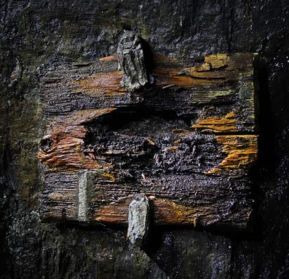
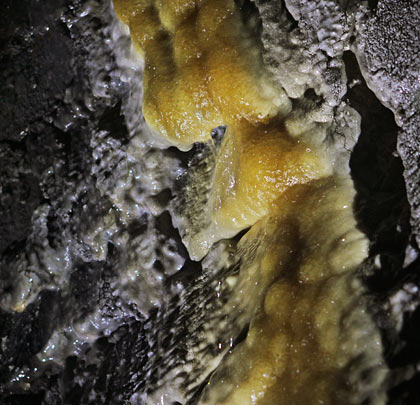
Near the tunnel’s midpoint, a collar of masonry is encountered into which a weep hole has been cut, allowing a spring to drain into the bore. This has resulted in mineral deposits forming on the wall and floor. Also visible throughout this section are holes drilled into the rock to hold the blasting powder. These indicate that, due to the rock’s great hardness, the advances were very short – perhaps in the order of 18 inches. The excavation was widened periodically to create safety recesses for the platelayers. Wooden tablets were fixed to the east wall as location markers; the rotting remains of one are still in situ.
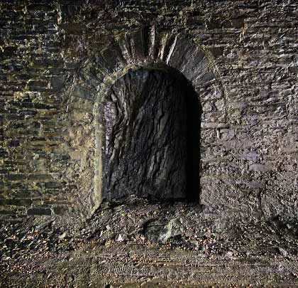
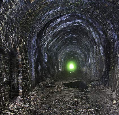
Further north is a second collar of masonry; a few yards beyond that, a continuous lining is introduced. It seems likely that this was a later addition, perhaps following the adoption of standard gauge. The lining accommodates refuges in both side walls and extends for about 100 yards to the north portal, suffering throughout from water ingress. This may have prompted its installation.
Two changes in profile are included, with the section between them providing a more generous vertical clearance. Here, there is some distortion to the arch. Only about six feet separates the northernmost profile change from the tunnel mouth.
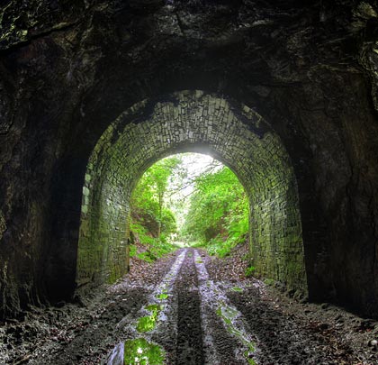
The north portal is smaller than that at the south end, with no parapet and only one string course. Today it is covered in vegetation and partially hidden by fallen trees. The approach cutting is short and incorporates a curve to the west. Beyond, the line crossed the 232-yard Castle Hill/Filleigh Viaduct, comprising masonry piers and seven lattice girder spans at a height of 94 feet. Although the ironwork was dismantled following the line’s closure, the piers now support the A361 North Devon Link Road.
Many thanks to the Castle Hill Estate for facilitating our site visit.

 October 2012