Calke Park Tunnel
Calke Park Tunnel
![The eastern portal has a remarkably flat profile and will eventually be compromised by the roots of a tree alongside it on the north side.](http://www.forgottenrelics.org/wp-content/uploads/2023/03/image1-36.jpg)
![Three concrete strengthening ribs have been inserted to ensure the safe passage of traffic on the Abbey road above.](http://www.forgottenrelics.org/wp-content/uploads/2023/03/image2-36.jpg)
![The profile soon becomes more conventional, suggesting that perhaps the eastern section was an addition to the original tunnel.](http://www.forgottenrelics.org/wp-content/uploads/2023/03/image3-36.jpg)
![At three locations, aperatures in the crown let light in.](http://www.forgottenrelics.org/wp-content/uploads/2023/03/image4-36.jpg)
![A view along the tunnel's length, revealing how the profile varies.](http://www.forgottenrelics.org/wp-content/uploads/2023/03/image5-36.jpg)
![The wider central chamber, with its stone sidewalls and brick arch.](http://www.forgottenrelics.org/wp-content/uploads/2023/03/image6-36.jpg)
![Looking out from the tunnel's skewed western entrance.](http://www.forgottenrelics.org/wp-content/uploads/2023/03/image7-36.jpg)
![Trees adopt a jaunty angle on the approach the tunnel's minimalist west portal which basically comprises the arch ring face.](http://www.forgottenrelics.org/wp-content/uploads/2023/03/image8-32.jpg)
![](http://www.forgottenrelics.org/wp-content/uploads/2023/03/image1-36.jpg)
![](http://www.forgottenrelics.org/wp-content/uploads/2023/03/image2-36.jpg)
![](http://www.forgottenrelics.org/wp-content/uploads/2023/03/image3-36.jpg)
![](http://www.forgottenrelics.org/wp-content/uploads/2023/03/image4-36.jpg)
![](http://www.forgottenrelics.org/wp-content/uploads/2023/03/image5-36.jpg)
![](http://www.forgottenrelics.org/wp-content/uploads/2023/03/image6-36.jpg)
![](http://www.forgottenrelics.org/wp-content/uploads/2023/03/image7-36.jpg)
![](http://www.forgottenrelics.org/wp-content/uploads/2023/03/image8-32.jpg)
Opened in 1804, the Ashby Canal formed a 31-mile connection between the Coventry Canal at Bedworth and the mining districts around Moira. Towards its northern end several tramways were constructed to serve local colleries, canal spurs deemed too expensive due to the cost of providing the necessary locks.
One of these routes, a product of renouned Derbyshire engineer Benjamin Outram, headed to Ticknall. Opened in 1802, it connected local brickyards and lime quarries with the canal at Willesley Basin, taking the form of a 4 feet 2 inch gauge plateway with angle iron rails set on rough limestone sleepers. Many of these remain extant throughout its 12½-mile length. The wagons – which also carried coal and other goods – were hauled by horses.
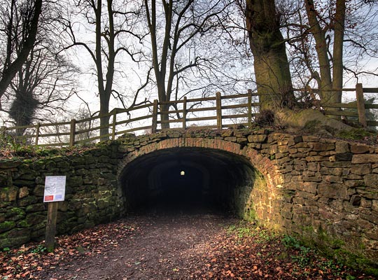
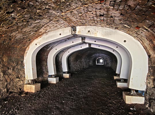
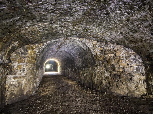
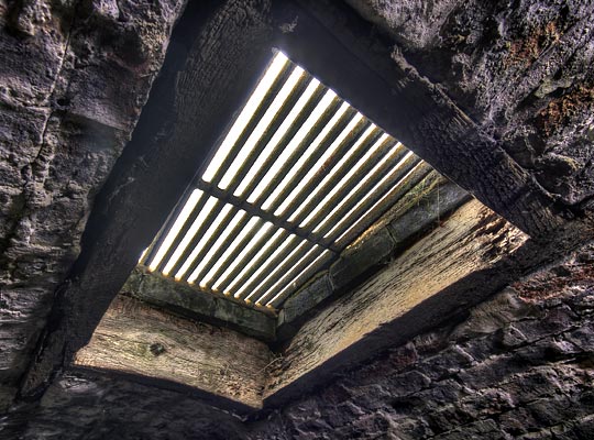
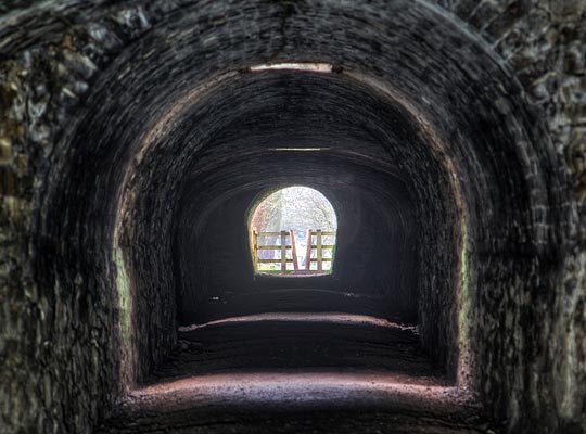
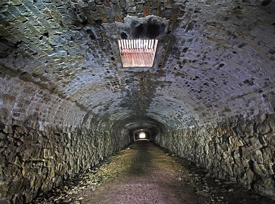
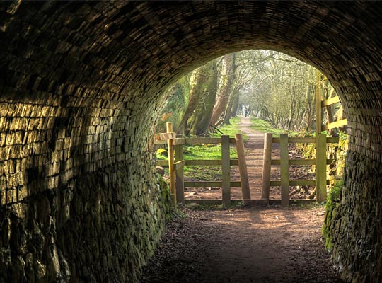
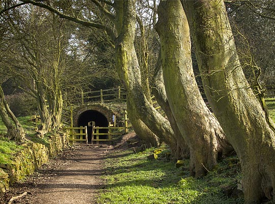
Two tunnels helped to navigate the estate of Calke Abbey: Calke Park at 138 yards and a shorter bore of around 51 yards at Basfords Hill. The former allowed the tramway to pass beneath the abbey’s carriage drive. Built using ‘cut and cover’ techniques, it is only just below ground level; this allows three openings to be incorporated in the crown, letting light in. Lined predominantly in blocks of dressed millstone grit, the tunnel’s profile varies considerably but measures no more than 8 feet high and 12 feet wide. Sections of brick arch are apparent close to both entrances.
The tramway was officially closed in September 1915 although it had last been used on 20th May 1913. For several years previously, only an annual Parliamentary train had been operated, in order to preserve the running rights.
Much of its route can still be traced today. Unsurprisingly, the tunnel fell into a state of disrepair over the years that followed. However it benefited from restoration work by the National Trust in 1995 and it has since had a footpath threaded through it.