On this day in 1849, 175 years ago, the six segmental arches of Twizel Viaduct carried their first live load following completion by the York Newcastle & Berwick Railway.
Featured videos...
Join us socially...
Fritchley Tunnel
Fritchley Tunnel
1/6
<>
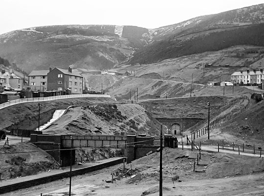
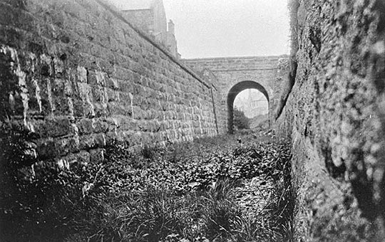
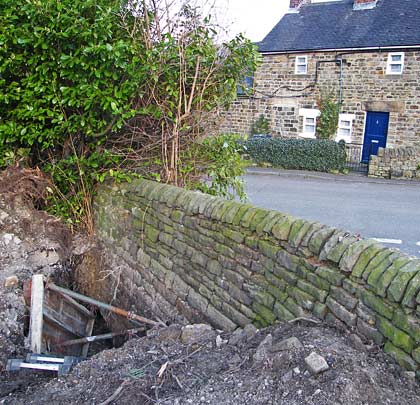
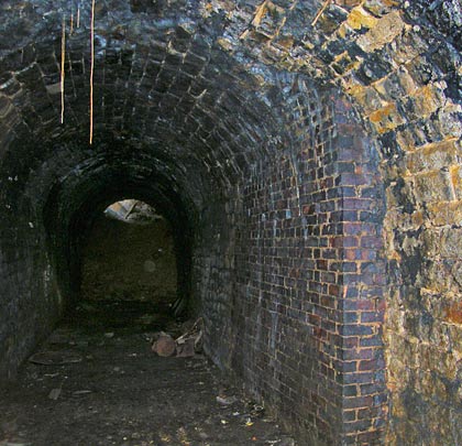
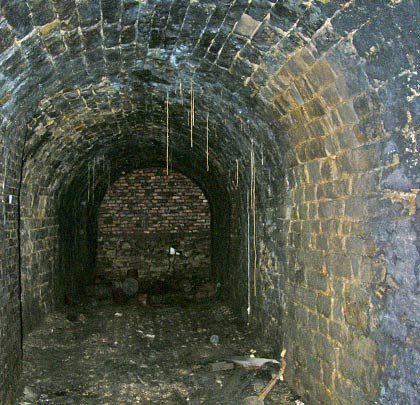
The tunnel, measuring about 32 yards, burrows below the junction where Chapel Street meets Front Street.
In 1793, a 3 feet 10 inch gauge tramway was laid for the purpose of transporting limestone from the old Hilt’s Quarry at Crich to the newly-constructed Cromford Canal at Bullbridge where limekilns were situated. Responsible for engineering it was Benjamin Outram. Originally horse-worked, an early steam locomotive was trialled on the line in 1813, travelling at less than walking pace. The quarry was abandoned around 1850 and a new one opened a little further west, necessitating a deviation of the tramway at its northern end. The route closed in 1935.
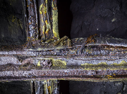
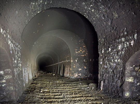
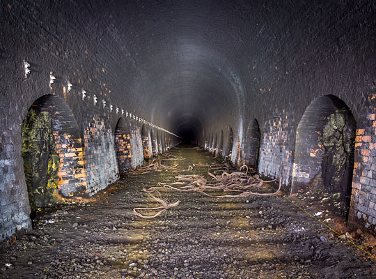
The single track passed beneath the junction of Chapel Street and Front Street in Fritchley by means of a tunnel, measuring about 32 yards in length. Its alignment was apparently altered during the middle part of the 19th century, resulting in a slight curve to the west.
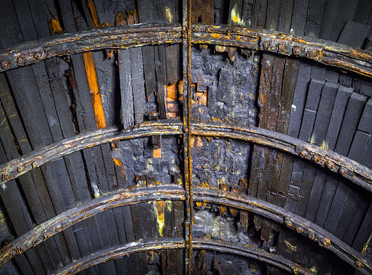
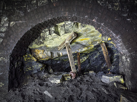
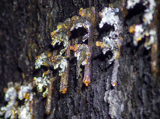
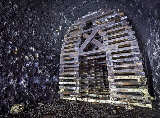
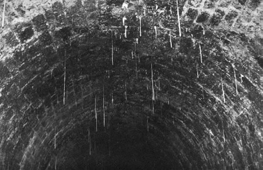
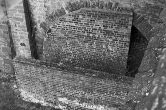
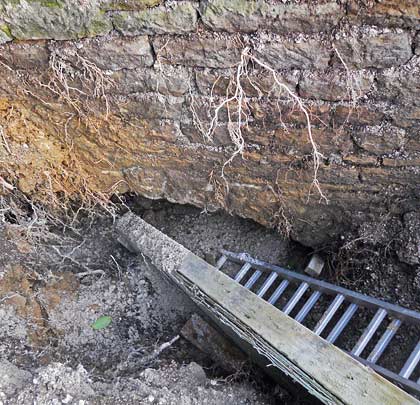
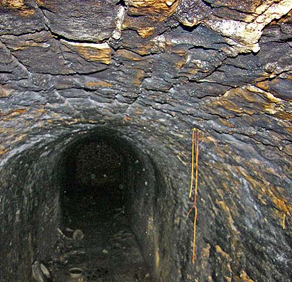
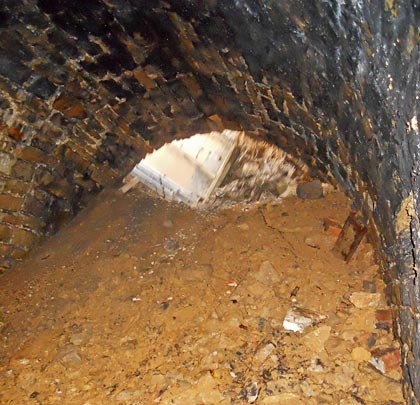
The modest structure is masonry lined, featuring an arch and vertical sidewalls. A short brick section has been inserted, presumably after closure to provide additional support for the road above. Numerous lengthy stalactites tell a tale of localised water ingress.
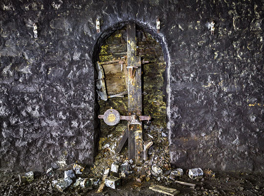
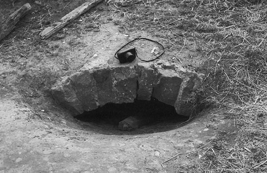
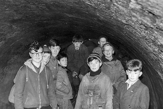
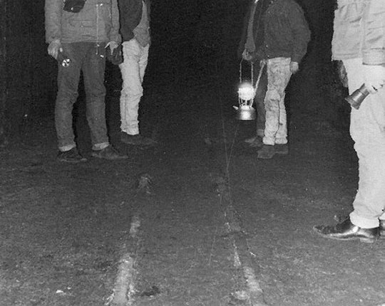
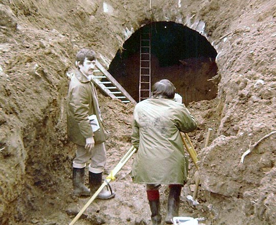
In the early 1980s, a blockwall was erected at the south end of the tunnel and spoil tipped in the northern entrance, effectively sealing the structure. But in 2012, the Derbyshire Archaeological Society received a grant of £17,900 from the Heritage Lottery Fund for the Butterley Gangroad Project which aims to discover and record the tramway’s history and surviving features. As a result, the northern portal has been exhumed, allowing entry into the tunnel once again. The structure was revealed to be mostly dry and in fair condition. Some sleeper indentations provide a visual clue to its original role.
April 2013
Fritchley Tunnel
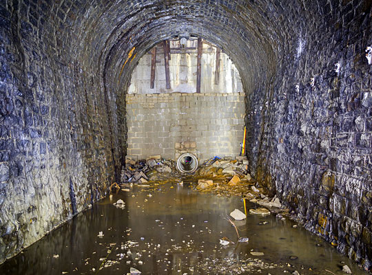
Rhondda Tunnel
1/23
<>
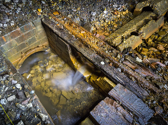
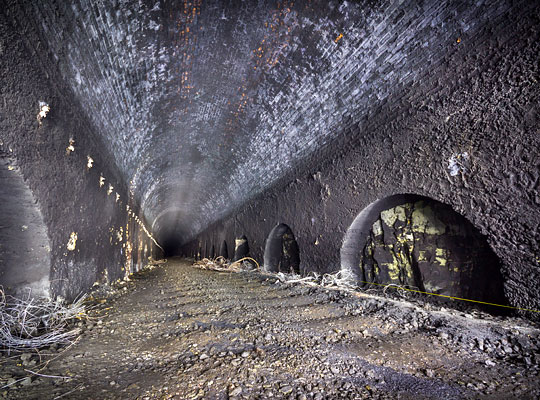
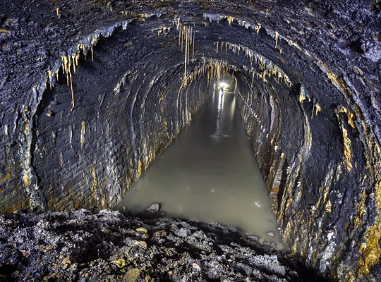
A very wet section of tunnel confronted those entering via the original access pipe.
Through the 1870s, increasing coal production in the Rhondda severely tested the handling capabilities of its monopoly carriers, the Taff Vale Railway and Cardiff Docks. Return journeys typically took two days. This background of crippling congestion spurred the merchant folk of Swansea – where new coal shipping facilities had opened – to develop plans for the Rhondda & Swansea Bay Railway (R&SBR).
Incorporated on 10th August 1882, the company proposed a shorter export route via the Afan valley but, to reach it, the line would first have to overcome a 1,700 feet high natural barrier, Mynydd Blaengwyfni. Set that task was engineer Sydney William Yockney; his father, Samuel Hansard Yockney, had acted as engineer and manager for the contractor at Box Tunnel, bringing him to the attention of Isambard Kingdom Brunel for whom he went on to fulfil a number of other tunnel projects.
Work on the R&SBR was split into three contracts, No.3 being awarded to William Jones of Neath. Included within it was the construction of Rhondda Tunnel, the second longest wholly within Wales and critical to the success of the venture. Completion was stipulated within three years. Serving as the resident engineer was William Sutcliffe Marsh.
Preparatory works began on site in the autumn of 1883 – including the sinking of a shaft at the western (Blaengwyfni) end – but the official breaking of ground was delayed until 30th May 1885. Thereafter excavation of the approach cuttings was pushed forward, although difficulties securing land at the eastern (Blaencwm) end – on which an entrance shaft was to be sunk – prevented substantive progress there for another 15 months.
Driving of the headings from the western shaft got underway in September 1885. After a very slow start, Yockney reported only marginal improvement over the subsequent months despite good ground conditions and little water ingress. In Jones’ view, the criticism levelled at him was unwarranted – citing the issues over land acquisition – but the engineer clearly felt that the works were not properly organised or resourced. Either way, the main heading was being excavated through sandstone at a rate of about 40 yards per month; “only very moderate progress” as far as Yockney was concerned.
With ground cover exceeding 900 feet, the conventional approach to expediting progress in lengthy tunnels – the sinking of intermediate shafts – was deemed impractical. However the miners did benefit from rock drilling machines, operated by compressed air which was generated by a pair of horizontal engines and stored in an iron tank before being passed into the tunnel. The machine’s exhaust acted as effective ventilation at the working face.
The drills’ arrival prompted a considerable upturn in fortunes, with the heading advancing thereafter at a rate of about 75 yards per month. Matters improved further when the contractor gained access to the outstanding parcel of land at Blaencwm, allowing work to begin on the shaft. The eastern heading was first pushed forward in November 1886.
Despite the miners’ industry, alarm bells were ringing loudly early the following year as progress started to slip; according to Jones, this was the function of a manpower shortage and the underground springs encountered towards the tunnel’s eastern end. Reluctantly, the company pushed back the contractual completion date to 31st July 1889.
It wasn’t until 16th March that year – with only 20 weeks to go – that the headings finally met. Yockney reported that the levels were out by just half-an-inch whilst the line was perfect, a remarkable result considering the length of the drives; he attributed it to “the care and skill” of Mr Marsh. The event was signalled by the firing of cannon and, four days later, the contractor entertained a hundred navvies to supper, song and recitals at a nearby hotel. But the glory was short-lived for the Tunnel Driving Company, subcontractors to Mr Jones. In December 1889, an extraordinary general meeting heard Chairman Tom Brown assert that it was “unable to continue in business by reason of its liabilities”.
Inevitably, the tunnel claimed more than just corporate casualties. John Harris, 24, killed by an explosion; William Shod, a haulier, run over by a wagon and fatally injured; Isaac Watson, 36, also succumbed to dynamite. And then on 22nd January 1889, news of a huge rock fall spread across the district; seven deaths were reported. Although an exaggeration, the reality – two victims – proved no consolation to the families of George Lever, a 28-year-old miner, and labourer George Smitherham, known to everyone as “Soldier”. Gangs of men laboured for many hours to extricate their bodies from the debris.
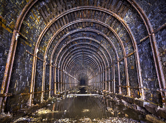
With the tunnel’s full excavation falling to just 98 yards per month – less than half of the rate required – the company dispensed with William Jones’ services in September 1889, bringing in Messrs Lucas & Aird from Westminster. Employing more than a thousand men to finish the line, they set about erecting new accommodation huts at both ends of the tunnel and, for four months, workers therein benefited from electric lamps. The western end was lengthened slightly, presumably due to instability of the cutting slopes.
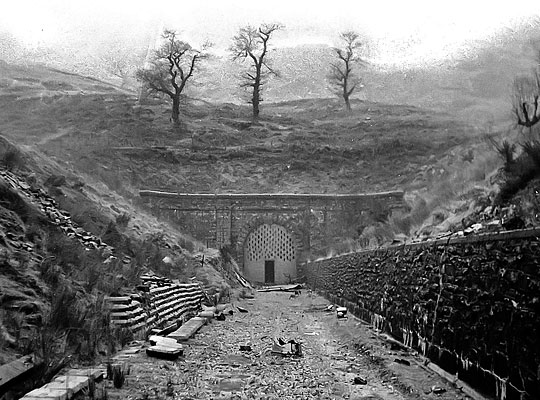
A contractor’s engine became the first to pass through the full length of Rhondda Tunnel on 17th March 1890. Seven weeks later, with Yockney confident of a tick in the box, Colonel Rich attended to fulfil his inspection duties for the Board of Trade. He expected to find the tunnel fully lined, but it wasn’t. So before he would pass it as fit for passenger traffic, 753 yards of brick arch had to be hastily inserted, springing off arched concrete sidewalls. Operations resumed the following day, Lucas & Aird having already prepared for such an eventuality. Completion came just 54 days later, allowing the tunnel to start earning its keep on 2nd July 1890.
Wise practice in mining areas was for railway companies to buy pillars of coal that supported significant structures. Failure of the Lancashire, Derbyshire & East Coast Railway to do so resulted in Bolsover Tunnel sinking by eight feet in 60 years. The R&SBR fell into the same trap of short-term economics, the upshot being areas of worsening distortion resulting from seams being worked both above and below Rhondda Tunnel.
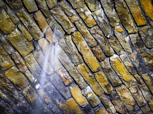
Between 1938 and 1957, steel ribs were installed over a distance of around 220 yards at the east end and through two sections totalling 170 yards about half-a-mile in, the intention being to resist inward movement of the haunches and consequential pushing-up of the crown. Speed restrictions were imposed and several lengths of arch were relined as loose material fell onto the track; settlement of 15 inches was recorded in just 12 years. All this was exacerbated by considerable water ingress close to the east portal which extensively washed out the mortar.
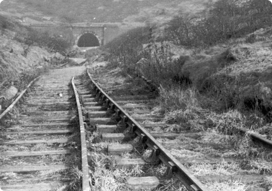
In 1967, severe distortion was observed near the 2¾ milepost – around a third of the way through from the west end, close to a geological fault. So rapid was its deterioration that the engineer closed the tunnel on safety grounds on 26th February 1968. This was supposedly a temporary measure whilst a decision was made on the future of the line.
Three months later, a special inspection revealed a 9-inch bulge on the north side of the arch over a distance of 100 feet, with signs of the stone lining being crushed and a hinge at the crown. As a result, it was decided to erect timber cribbing – now known as ‘the cog’ – from 2 miles 61 chains 57 feet to 2 miles 62 chains 63 feet, a distance of 72 feet. A second inspection in October 1969 found that the distorted section had extended by 9 feet.
After much prevarication, the Ministry of Transport cited a decline in usage and the provision of a bus service as justification for the formal withdrawal of passenger services in December 1970. A cynic might suggest that the tunnel’s estimated minimum repair cost of £105,000 also had an influence.
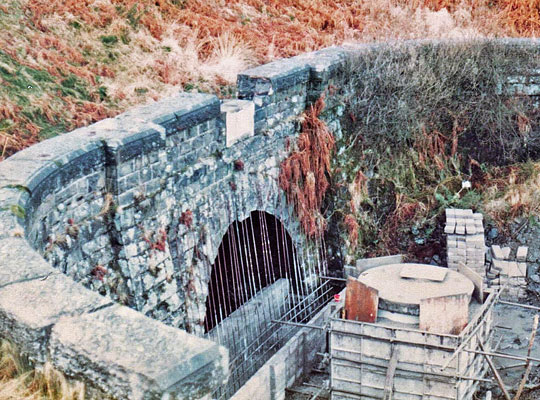
For ten years, the tunnel was largely left to its own devices. Then, with locals persistently breaching its protective blockwalls, contractors infilled the approach cuttings on behalf of the local authorities. At the western end, a double-diaphragm wall was erected adjacent to the tunnel’s only ventilation shaft, creating a sealed section of about 90 yards in length. At the other end, an access shaft was created using precast concrete rings, although no-one officially descended it for 35 years.
In September 2014, 19 locals assembled at The RAFA Club in Treorchy to discuss plans for the east portal’s cover stone – which had recently been discovered under a bush – to be rescued, restored and put on display. One of those in attendance suggested that they should campaign for the tunnel to be reopened as a walking and cycle route. Thus, the Rhondda Tunnel Society was established to progress this ambitious aspiration.
Engagement from the Welsh Government and other relevant bodies has been positive, and a detailed examination of the tunnel took place in spring 2018 with a view to developing a repair scheme. It was concluded that, from an engineering perspective, all defects could be rectified and managed. Based on this finding and the associated costing, a decision will be taken as to the viability of transferring the structure’s ownership from the Department for Transport, a pre-requisite of the reopening proposal being moved forward.
In August 2018, the Welsh Government awarded Rhondda Cynon Taf Council £250,000 to help it develop its plans for the reopening of both Rhondda and Merthyr tunnels.
April 2013
Rhondda Tunnel
Elliott Simpson recalls his Sixties incursion into Law Tunnel: An underground adventure
One of my early childhood memories was of my dad lifting me up to look over a wall to see the entrance of the railway tunnel “under” the Dundee Law – in fact it started just below the crest of a shoulder of the hill. That night, in my dreams, we found another entrance behind the High Kirk, which stands more or less directly above the tunnel, and we found an ancient steam engine in the middle of the tunnel. I think that, subconsciously, I was still searching for it when I later explored the tunnel, only to find its spitting image 40 years later and 400 miles away in the Canterbury Museum.
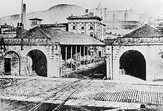
The Dundee & Newtyle Railway’s original southern terminus on Ward Road.
In the mid-1960s, I took a series of photos showing the remains of the railway which ran from Dundee to Newtyle. The stimulus to start looking for it – and particularly for the buried north end of the tunnel – was probably a conversation with the mother of a former school friend who said that, in her youth, it had been possible to walk through the tunnel, although she had never done so.
I had heard that there were traces of the trackbed out in the countryside and, within the town, there were several buildings which sat at odd angles to the adjacent roads because they had been built to align with the track. I was surprised to find that one of these buildings was my father’s own printing works where I used to watch the steam trains shunting the trucks on the Fairmuir marshalling yard and another was the laboratory block at the Royal Infirmary where I started my career as a biochemist.
The railway was fairly frequently referred to in the local newspaper, the Courier. Typical of these items was the following, which had found its way into the envelope in which I kept the photos.
The train with a sail
Did you know a railway train with a sail once ran from Dundee?
In Auchterhouse Old and New, by the Rev J Kirkland Carneron and M Oliphant Valentine, the authors say this about the old railway from Dundee to Newtyle (the first in Scotland): “On the level sections of the line traffic was brought by horse haulage. When the wind was favourable, speed was accelerated by the hoisting of a wagon sheet on a pole attached to the carriage. When the breeze failed or the wind was contrary, William Whitelaw and his horse brought the train to the station.”
One picture taken in 1898 showed a railway coach, with sail hoisted, approaching Ardler on the Newtyle to Coupar Angus line. On the track behind the train is the “driver” on horseback, ready with his mount to come into action. In these days a single coach made up the train.
Today the railway continues to make appearances in contemporary documents, such as the Dundee Royal Infirmary Site Planning Brief. In the description of the site, there is noted that “there is a clear change in level between the site of the original building and the Gilroy/Caird/Dalgleish/Loftus wings to the north. This is marked by a series of retaining walls. The site falls sharply to the south boundary from the parterre. To the east the former Burns Unit, Pharmacy and Maternity Wings mark the change in level between Clarence House and the east site. It is through these buildings that the route of the former Dundee and Newtyle railway line runs.”
The railway company was formed in 1826 and in the following year tenders were invited for contractual engineering works. This was the first railway to be built in the north of Scotland. It was planned as a link between the manufacturing city of Dundee and the fertile valley of Strathmore. However it terminated at Newtyle which, at that time, was little more than a mill and a few houses, rather than Forfar or another of the larger Strathmore towns.
The line was built with a 4 feet 6½ inches gauge – there being no accepted standard gauge at that time. It had several unusual features. Rather than going round them, Charles Landale, the engineer, decided on a policy of ‘up and over’ for the Sidlaws – a range of hills – and this resulted in three inclines, at Law (1:10), Balbeuchly (1:25) and Hatton (1:13). The inclines were worked by stationary steam engines. Initially the coaches and wagons were pulled by horses over the intervening level stretches of line. Later two steam locomotives were used although horses provided the back-up when the locomotives broke down.
In its own way the railway was one of the most important early lines in Scotland, opening to traffic on 16th December 1831. It was the first not to rely on a coalfield for the bulk of its traffic, being built to connect the farming areas to the north of the Sidlaws to the harbour in Dundee, carrying general traffic in both directions. The railway was leased to the Dundee & Perth Railway in 1846 and became part of the giant Caledonian system in 1865. Standard gauge was adopted in 1849 and during the 1860s deviation lines were opened to avoid the three inclines, which then fell into disuse.
The Law incline, captured in the 1930s, around 70 years after it was closed. Photo: J F McEwan
The Law incline ran parallel and to the west of Constitution Street, through the grounds of the Royal Infirmary. The following details are taken from the Account of the Dundee and Newtyle Railway in The Quarterly Journal of Agriculture, Volume IV No XIX, 1833.
“The depot at Dundee is 84 feet above the low-water mark at spring tides in the harbour. The first inclined plane, then, rises from the depot in the Ward to the east side of the Law, 244 feet perpendicular height, along an inclination of 760 yards, at the rate of 1 in 10; then the tunnel is passed through in 400 yards.”
“The waggons and carriages are drawn up and let down the incline by a rope three inches in diameter. The rope passes over metal pulleys and cylinders set about 20 feet apart. It is wound round a large drum of 12 feet in diameter, which is under the command of the engineer by a powerful drag. The inclined plane has a siding upon it. The [stationary] engine [at the entrance to the tunnel] works a double rope, and as this has the steepest inclination of the three, the ascent of waggons at the same time moderates the speed of the descending weight. At the plane where the waggons pass on this incline, the rope is of course bent out of the straight line, and is kept in that position by a sheave of metal of a conical shape, revolving on its longitudinal axis.”
“The [stationary] engine…is a high-pressure one of 20 horse power, made by Messrs Maudesly & Co London. A telegraphic board is placed at the bottom of each inclined plane, to announce to the engineer at the engine that the waggons or carriages are ready to be hauled up; and in thick weather a large bell is rung. A lantern could be used at night, but it is thought inexpedient to use the railway after night-fall for the present.”
In James Nasmyth: Engineer, an autobiography, there is a description of the first adventure by train of an old woman from Newtyle to Dundee. “The woman was on her way down hill, with a basket of eggs by her side. Suddenly the rope broke and the train dashed into the Dundee Station, scattering the carriages, and throwing out the old woman and her basket of broken eggs. A porter ran to her help, when, gathering herself together, she exclaimed, “Odd sake, sirs, d’ye aye whummil (whummil: to turn upside down) us oot this way?” She thought it was only the ordinary way of delivering railway passengers.”
Stalactites hanging from the tunnel’s masonry arch. Photo: Elliott Simpson
The tunnel through the Law was completed in 1829. Its construction was also described in The Quarterly Journal of Agriculture. “The greatest difficulty occurred in cutting the tunnel through the eastern acclivity of the Law of Dundee. The greatest portion of this hill composed of greenstone and greenstone porphyry, a stone well adapted for the paving of streets in towns. It was reasonably expected, that the sale of the larger blocks of this rock for paving stone, and the smaller for broken stones for roads, would have realised as much cash as would have paid the expense of mining the tunnel, while the rock itself would have formed a natural archway. But, as Burns truly says, “the best laid schemes of men and mice aft gang agley.” After penetrating a short distance at both ends of the tunnel, it was unfortunately discovered that the line of it had accidentally been fixed up from below with a soft steatitic rock, in a highly disintegrated state, quite unable to withstand the process of mining. Under these unfavourable circumstances the tunnel had to be lined up on both sides with walls, and arched over with freestone and mortar. Thus, instead of realising the reasonable anticipations of a saving of expense, the formation of the tunnel incurred an extraordinary outlay.”
In the mid-1960s, ground movement caused the top of the tunnel’s northern entrance to become exposed. Photo: Elliott Simpson
At the outbreak of World War II, the emergency Committee asked the LMS Railway Company for the use of the Law tunnel as a shelter. According to This Dangerous Menace: Dundee and the River Tay at War, 1939 to 1945 by Andrew Jeffrey, “This was agreed to at a rent of one pound per annum, provided the Corporation undertook to return the tunnel to the condition in which they found it. In February 1941 Ellen Wilkins, Minister at the Home Office, noted that the Law tunnel had no amenities and described it as one of the wettest shelters she had ever seen. In addition it was very cold and was never a success. Plans for a grid square of tunnels westward of the present tunnel with exits to Kinghorn Road were quietly dropped.”
The south entrance was still open in the 1960s, tucked in below a wall at the top of Upper Constitution Street. It then ran under some allotments and between houses on the north side of Law Crescent. It was in some nearby allotments that my friend and I found the north end of the tunnel. It had been covered with rubble but over the years the ground level had lowered, revealing the top of the arch – and that gap was wide enough for us to get inside. A few minutes later we were at the south end, congratulating ourselves that we had achieved what his mother had not.
The group of happy adventurers, going where no-one had gone for many years previously. Photo: Elliott Simpson
A few weeks later, we returned in the evening with a group of kids from the Broughty Ferry Crusader Bible Class, where I was a leader. As we were crawling into the tunnel, three local lads came to see what we were doing. Rather than leaving them outside to report who-knows-what to who-knows-who, we took them – very willingly – along with us.
The mound of rubbish inside quickly descended to the original tunnel floor level. Half way through there was a blast wall and on the north-facing side were the words “EMERGENCY EXIT”, so one assumes that the north end of the tunnel must have been open in the 1940s when it was used as an air raid shelter. Rails were still in place, said to have been laid for a narrow gauge track way used by a company which grew mushrooms in the tunnel. Hanging from the masonry lining were hundreds of stalactites.
The narrow gauge track embedded in the tunnel floor. Photo: Elliott Simpson
The track through the tunnel and the north side of Dundee ran more or less level for 4¾ miles until it reached the second incline at Rose Mill in the Sidlaws. In 1833 The Journal of Agriculture stated that “The level spaces are so constructed that they each form two straight lines, with the view that should it afterwards be thought expedient to adopt stationary engines instead of horses, they could be erected at the meeting of the straight lines for the dragging of waggons along the levels.”
It is probably for this reason that there are several buildings which now appear to be out of align with the road system, because they were aligned to the track. One of these was the station master’s house in the grounds of Kings Cross Hospital on Clepington Road; another was Trendell Simpson, the printers in Lintrathen Street. This latter building was bought by my father in 1948 and the business has been in the family ever since.
The northern end of Law Tunnel was exhumed in 1981 to faciltate a survey prior to the adjacent housing being built. Photo: Elliott Simpson
In Priestley’s Navigable Rivers and Canals, the length of the first level section is given as nearly 4¾ miles. At the end of this was the second incline which took the line up a height of 200 feet over a distance of 1,690 yards. This was the Balbeuchly incline. It had a gradient of 1:25 and was named after the farm at the summit. The bottom end of the incline was at Rosemill. In 1966 there were two intact bridges, and another without its spans, which crossed the Dighty Water – the local stream – and a mill lade at Rosemill. The centre bridge led to the deviation line which was opened in the 1860s.
The Journal of Agriculture states that “a difficulty occurred at the forming of the inclined plane at Balbeuchly. Here the great hollow in the fields had to be filled up to the height of about 40 feet above the ground; and this great embankment was formed of travelled rubbish. To obtain materials for filling up as near to the spot as possible, a portion of the ground at the top of this inclined plane was removed, which had the effect of keeping down the height of the level over the bog of Auchterhouse, and affording space for the engine-house.”
Priestley’s Navigable Rivers and Canals gives the length of the second level section as being four miles and a furlong, with a rise of only 3 feet 9 inches. The track bed from the top of the Balbeuchly incline can be seen as a wooded embankment crossing the fields and meeting the end of the second deviation just to the north of Auchterhouse Station.
The line from Auchterhouse north runs across a former marshy area. In the Journal of Agriculture it is said that “One difficulty was the passing over the bog of Auchterhouse, the moss in which has always been of so soft a consistency that no cattle could walk across it. The passage over it was accomplished by digging the moss to a considerable extent on each side of the railway, and throwing it up in the shape of an embankment, upon which the railway is placed above the ordinary level of the moss. The large ditch thus formed on each side of the railway not only dried the moss upon which the railway rests, but it has drained the bog for a considerable distance on each side; so that corn and grass may be seen growing where they never did before. The slopes of this mossy embankment are planted with trees appropriate to their situation, such as willows, poplars, spruces, and alders.”
The 1:13 Hatton incline at the northern extreme of the line, was the last of the three stationary engine-worked inclines to close, when it was superseded by a deviation line in August 1868.
The station at Newtyle was the terminus of the Dundee & Newtyle Railway. In 1833 the line had 31,000 passengers, a number which had risen to 61,000 by 1839. In a very real way, the railway brought Newtyle into being.
The ‘Scottish Rambler’ special, visiting Newtyle’s original station in April 1962.
Although it was always intended that the line should be steam powered, it was recognised that horses would provide the pulling power in the early stages. In the Journal of Agriculture, it is pointed out that, “although at the time when this railway was constructing, the Stockton and Darlington railway was the only one which was in existence on the same principle, the workmanship of the Dundee and Newtyle one is very superior to any one even now in use. The using of large stone-sleepers to support the rails, the placing the rails high above the horse foot-track out of the reach of mud, and the peculiar mode in which the rails are keyed into the iron chairs, which prevents their starting up, are peculiarities and superior modes of workmanship on railways which were first exhibited here. Indeed, on the whole, this railway is a piece of work, both as to the direction of the line and the style of the workmanship, that reflects the greatest credit on the professional talents of the engineer.”
Some idea is also given of the rolling stock. “Carriages for the conveyance of passengers are made of various forms, but they all move on the same kind of wheels as common waggons. There are close-bodied coaches, open vehicles with awnings, parcel waggons, and covered carts with benches, for poor people on market days. One horse trots with a number of them together at the rate of eight miles in the hour. Once we were conveyed along with 64 passengers by one horse at that rate. The motion in riding is not so smooth nor so noiseless as one might imagine; but this may be owing to the rails being placed on hard stone-sleepers, for on those parts where the wooden sleepers have not yet been removed, the motion is much smoother.”
“The service waggons are made of wood or plate-iron, we believe the later are preferred. They discharge their contents through the bottom. They are placed on a frame-work, supported on four wheels of cast-metal, 35 inches in diameter, and they weigh about one ton each, and are intended to carry a burden not exceeding two tons. They are fastened together by a strong iron bolt passing through eyes in bars of iron, and at the inclined places they have precautionary safety chains attached to them. They have each, besides, a drag, like a hammer-headed lever, which operates on the tires of the fore and hind wheels at the same time. Four waggons loaded, of a gross weight of 12 tons, is one horse draught; and he can walk away with this at the rate of at least three miles in the hour.”
In the Journal of Agriculture there is a series of calculations on the weight of crops, etc. which might be expected to be transported out of the Vale of Strathmore. There is also the following section which estimated the costs of running steam locomotives on the lines, rather than using horses.
“The level part of the railway has hitherto been served by horse power; and at the outset of such a work as this, when the business upon it had to be acquired, and no certain anticipations of great immediate traffic could be depended on, it was highly expedient not incur the expense of locomotive steam-engines. As the strength of the rails is only 28lb per yard, it is very questionable whether that strength could have borne the locomotive engines which were first used, especially such as those used on the Liverpool and Manchester railway, which weigh from 6 to 8 tons each, and are borne on a rail of the strength of 36lb per yard. Under these circumstances, Mr Nicholas Wood, the eminent colliery surveyor at Kilingworth, recommended the weight of carriages with the goods not to exceed 3 tons each, and that they should be propelled by horse-power. In this manner the business of the railway has gone on hitherto very smoothly, one horse dragging along four loaded waggons of 3 tons each, at the rate of perhaps more than three miles per hour. The rate of freight is 4d per mile per ton.”
“Now, however, that locomotive engines are improved in their construction, and the economy in their consumption of fuel seems to be brought down to the minimum point, it is worthy of immediate consideration, whether they should not be employed on this railway in preference to horses. The two level plains would require an engine each. The light engines of Mr Gurney’s construction could work upon them with great advantage.”
“But as example is better than precept at all times, and particularly in matters of experiment, we shall state what one of Mr Gurney’s locomotive engines performs on a railroad in Wales. Mr Crawshay of the Cyfarthfa iron-works in Glamorganshire, South Wales, states in a letter to Sir Charles Dance in February 1832, that the engine which he got from Mr Gurney for his railway at Hirwain, did not weigh above 35cwt, including water and fuel, and every other thing in a working state; that this engine conveyed, between 1 January 1831 and 1 January 1832, of coal, ironstone and iron, from 20 to 30 tons at a time as suited convenience, exclusive of the weight of the carriages on which they were drawn, 42,300 tons a distance of 2½ miles; that during that time the engine was half idle, though it was kept “working idle”, as he expresses it, in order to keep the boiler full; that the quantity of coals consumed in that time was 299 tons at 3s per ton, £44,17s; that the wages of the engineer was £52, and those of a boy £15,12s; and that with oil and other trifling matters the whole expense amounted to £112,9s, or less than one farthing per ton per mile for the goods conveyed; and that from his long experience of horse power on railroads, he conceives that steam power is cheaper than it, in the proportion of 1 to 20 or 30. He concludes by earnestly recommending the cheaper power of steam, wherever practicable, for that of horses, and says there are “many other valuable considerations in favour of that of steam, known only to those who have large and expensive stable.”
A view towards the summit of the Balbeuchly incline. Photo: Elliott Simpson
In 1810, James and Charles Carmichael founded the Dundee company which produced the first locomotives for the Dundee and Newtyle Railway in 1833 – these were, in fact, the first locomotives made in Scotland. It is said that they were the first in the UK to have bogies. Prior to that, the company’s main activities were marine work, weighbridges and turbines.
The first locomotive, No.1 and named Earl of Airlie, was delivered on 20 September and No. 2, Lord Wharncliffe, on 25 September 1833. These were the names of two of the local land owners who were principal share holders in the company. They were both 0-2-4s. The cylinders were placed on each side of the boiler; the crossheads above the cylinders were connected to large bell cranks, the longer arms of which were coupled to the connecting rods fastened to outside cranks on the leading 5 feet 4 inches diameter wheels. All wheels had laminated springs above the frames. The steam admission was by means of a valve on the boiler barrel, operated from the footplate by a handle and shaft. The feed check valve was on the side of the raised firebox.
Early in 1834 a third locomotive was built by Stirling of Dundee to the same general design as the first two, and named Trotter. A fourth, called John Bull, was obtained in 1836 from Robert Stephenson & Co of Newcastle. Unlike the other three, this had the 0-4-0 wheel configuration.
An extension of the railway onwards to Glamis was authorised in 1835, opening to goods in 1837 and to passengers in 1838. It was built by an independent company, the Newtyle & Glammiss Railway, the company using the old spelling of the village name. Around the same period, the separate Newtyle & Coupar Angus Railway opened. Eventually both of these railways were taken over by the Scottish Midland Junction Railway and used in part for the new route between Perth and Forfar, opened in 1848.
Passenger trains operated on the Dundee & Newtyle from its earliest years. All trains were operated according to parliamentary regulations introduced in 1844. In February 1862, there was a service of three trains in the Dundee-Newtyle direction and four the other way, with a fifth on Fridays. Some trains were mixed, for both goods and passengers. Connections onwards from Newtyle to Coupar Angus, Blairgowrie, Alyth, Glamis, Kirriemuir and Forfar were available; also a service of short workings between Dundee and Lochee. By this date both the Law and Balbeuchly inclines were closed but trains would have required to use the stationary engine-worked incline between Hatton and Newtyle until 1868.
The southern end of the tunnel was blocked off in 1982. Photo: Elliott Simpson
Closure of the railway came in stages, with the section between Newtyle and Auchterhouse the first to succumb in 1958. The rest survived into the 1960s but the history of the Dundee & Newtyle Railway ended on 6 November 1967 when the Law incline deviation line closed between Ninewells Junction and Maryfields Goods station. The north end of the Law tunnel was lost again when housing was built on the allotments where I had found it; the southern entrance was bricked up and buried in 1982. But however much it gets hidden, the tunnel will always remain in my memory thanks to the excitement of that underground adventure.
Elliott Simpson recalls his Sixties incursion into Law Tunnel: An underground adventure
The story of Clifton Hall Tunnel: Black Harry’s Timber Timebomb
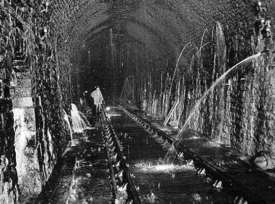
It’s fair to presume that Monday 13th April 1953 began like any other for ganger E C Nash. His duties that morning held no surprises, or so he must have thought. Ahead of him was a routine inspection of Clifton Hall tunnel, a 1,298-yard tube under the Manchester district of Swinton. It was a grim structure and wetter than most, not that Nash would have been over-bothered after 12 years of regular visits. But that day did prove different. Standing quarter-of-a-mile from its southern portal, he encountered something he’d never seen before.
Clifton Hall was infilled in 1959. This was the scene at the southern end shortly before work began.
In 1845, a bill was placed before Parliament for a new line connecting Liverpool with Lancashire’s great industrial towns – Wigan, Bolton, Bury. It would challenge the established Liverpool and Manchester Railway which had enjoyed a stranglehold on traffic between the two cities since the ribbon was cut 15 years earlier.
The LMR conceived its 3½ mile Clifton branch, linking the main line at Patricroft with Bury via Molyneux Junction, as a spoiler. Though it had little strategic value, its promoters thought it would stifle the prospects of their rival. Hindsight showed this belief to be somewhat misguided when the two routes received Royal Assent within a fortnight of each other.
Completed in 1850, the branch settled down to a life of no importance – lost in the vast corporate workings of the London and North Western Railway, its new owner. Passenger trains were withdrawn after a matter of months although freight traffic continued to serve a handful of nearby collieries.
Clifton Hall’s southern approach cutting has disappeared to create a public space.
For a fifth of its length, the double track line ran out of sight within the confines of Clifton Hall tunnel – brick lined and straight. Locally it took the name of its dark-whiskered foreman, ‘Black Harry’. Construction was a nightmare thanks to the mix of clay and loose sand through which it had to be driven. Eight shafts were sunk to speed progress. These were later infilled and sealed – none was retained for ventilation or marked within the tunnel. Records of their location remained on file in the District Engineer’s office until they succumbed to the air raids of 1940 and a fire in 1952.
The structure sat 1,500 feet above the area’s coal measures, resulting in some settlement of the structure over time. Coal was first worked from seams below the northern portion. Although no movement had been detected, 617 yards of lining received reinforcement ribs – fashioned from old rail – in 1901.
Conditions became less than satisfactory towards the other end. In the spring of 1912, defects showed themselves around two of the hidden shafts. A specialist tunnel gang rebuilt short sections of wall and arch. Another quarter mile of lining, extending north from the portal, underwent precautionary bracing in 1926, leaving a central section of around 300 yards entirely self-supporting.
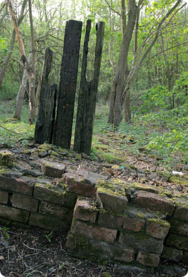
These are the remains of a wall which ran along the top of the northern portal’s approach cutting. Infill and vegetation has reclaimed the trackbed but ground movements occasionally reveal small sections of the portal’s brickwork.
The land above remained largely undeveloped until the turn of the 20th century. As part of Swinton’s expansion, 1909 marked the building of a cul-de-sac of semi-detached dwellings, crossing the tunnel at an angle. This was named Temple Drive. Fred and Clara Potter made their home at number 22. Sara Salt and her two daughters, Jean and Emily, lived next door at 24.
Built into the tunnel wall were markers – known as tablets – spaced 50 feet apart and used to identify locations along its length. On the morning of his inspection, Ganger Nash had walked as far as the 29th tablet, 483 yards from daylight, when his attention was drawn to small collection of rubble lying on the Up line. In his experience, despite its flaws, Black Harry had never shed brickwork before. He shone his handlamp upwards. Some of the lining appeared to be peeling away. He made tracks to stop traffic and break the bad news.
All and sundry came to look. First the District Works Inspector, J W Glass, accompanied by the P-Way Inspector. Chief Works Inspector Ashall made a further appraisal. After dinner, E F Boivie, the Assistant District Engineer examined the structure from track level, his boss being on holiday. He concluded that the route should remain closed pending repairs – loss of the little-used line would cause little inconvenience to the operating department. Responsible officers had taken prompt and proper action.
Next day District Engineer A L Owen returned from leave. Together with Mr Boivie and several colleagues, he made a detailed inspection from the top of a wagon. Between a pair of butt joints, two strips of brickwork had fallen from the roof, each 3 feet 6 inches long and 4 feet 6 inches apart, end-to-end. A substantial piece of rotting timber had been revealed, embedded within the lining which, here, was three feet thick. The crown of the arch had sunk by two inches compared with the rest of the tunnel.
Serious strengthening was needed. A draughtsman took profiles close to the defects, completing his drawings six days later on Monday 20th April. He had been diverted by other commitments. Rails were ordered from Gorton works. By this time, their supporting putlogs were already awaiting them, secured in the tunnel wall.
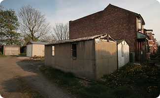
A gap still exists between the houses on Temple Drive.The land above the shaft now supports a collection of garages.
Monitoring took place daily. Little change was noticed until Tuesday 21st when the crown dropped by 3/8 inch. On each of the following two days, a 3/4 inch movement was recorded. Cracks began to develop. Both Boivie and Owen made return visits. The brickwork on the Down side was splitting and flaking in places. A gap had opened between the face and centre rings. It was not looking good. A bridge examiner inserted wedges. Timber props were prepared as a stopgap measure although these were never used as, by the weekend, three sets of reinforcement rails had emerged from Gorton’s workshop.
Plans were made to fix these in place on Sunday 26th. Such were the difficulties encountered that it was late afternoon when the first assembly had been erected on wagons, ready to be pushed into the darkness. It then became clear that insufficient allowance had been made for the tunnel’s irregular shape and ongoing settlement – the ring began to scrape against the wall. After much effort, it was installed 12 feet short of its intended position, clear of the damaged area. Work was then abandoned for the day.
Next morning a draughtsman took fresh profiles and arranged for the remaining rings to be modified at Gorton. These would be fitted on Wednesday – that, at least, was the intention.
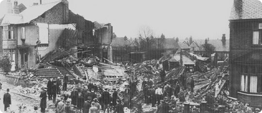
The first light of a new day was beginning to paint Temple Drive. It was 0535 on the morning of Tuesday 28th April 1953. At number 21, Police Inspector Kenneth McClennan had not yet risen. Suddenly, from underground, came a sharp cracking noise. He rushed to the window. Across the road was a pair of semis, numbers 22 and 24. As he watched, they folded inwards and disappeared into the ground. The adjacent property, number 26, had its end wall sucked away. A violent rush of air blew clouds of soot and dust skywards.
Rescuers descend on Temple Drive to help search the wreckage of three devastated houses.
Within five minutes of McClennan’s alarm, the first ambulances had arrived. Fire brigade and police followed. Locals hurried to help sift through the debris. Confronting them was a crater, 20 feet deep. Into it was tipped timber, tiles, brickwork and a section of roof.
Agnes Williams, the 77-year-old resident of number 26, was lying near the pavement, buried in rubble up to her waist. She was calm and relatively unscathed. Three neighbours pulled her clear. Her maid, Frances Watson, was then seen standing against the wall of her devastated bedroom, alongside an overturned wardrobe. Miraculously, she had survived the collapse despite the loss of her bed. Rescuers soon brought her down.
The community rallied round. Tea and cigarettes were provided. Manpower arrived from a nearby factory. The mayor came to get his hands dirty.
Amongst those in attendance was Whitefield’s Station Master, T Jones, occupant of number 11. It was his call to Manchester’s Chief Controller which kicked the railway into action. District Engineer Owen was underground within 40 minutes. Sixty feet down, a mass of sand and clay completely blocked the passage. Loose brickwork was still falling from the hole in the roof.
It was later in the afternoon that the first body was recovered – Fred Potter, aged 87. Then came his wife Clara, 73, and Jean Salt from next door who, at 28, was the youngest victim. Sara Salt, 69, and daughter Emily, 45, were found still in their beds, 15 feet below ground level. Black Harry had claimed five lives.
Work to secure the tunnel got underway the following day. Even this was not without incident. Four workers were overcome by diesel fumes after a small concentration of gas built up, caused by lighting equipment. On 1st May, work came to an abrupt halt after more rumblings were heard. But, with ashes packed solidly at either side and timber bulkheads in place, the fall was finally sealed nine days after the roof came in.
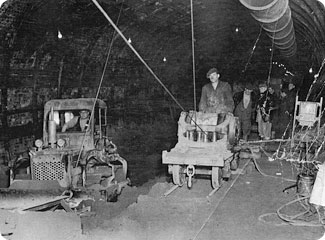
A hive of industry at Clifton Hall’s northern portal during operations to infill its barrel. Photo: Coal Authority Archive The work was managed by the Coal Board which built a 2-foot gauge wagonway in the tunnel. Battery operated locomotives were brought in to assist. Photo: Coal Authority Archive
Brigadier C A Langley conducted the official inquiry on behalf of the Minister of Transport. He concluded that the failure was “in no way attributable to mining subsidence but due to an inherent weakness in the construction of the tunnel.” During his investigations, an old progress plan had been unearthed in the Civil Engineer’s office at Euston. This contained details of the construction shafts which were located by reference to the tablets. Shaft 3 was buried directly beneath the spot where 24 Temple Drive would later be erected.
The timber exposed by the original fall of brickwork formed part of a frame which supported this shaft. It was slowly being crushed by a 200-tonne column of wet sand perched on top of it. This, together with a century of decay, resulted in a massive load being transferred onto the tunnel arch. When the timber finally gave way, the brickwork could not withstand the pressure, allowing the contents of the shaft to break through catastrophically. A vacuum pulled the houses into the void above.
Assistant Chief Works Inspector H Bradley had been making annual inspections of the tunnel since 1947. His detailed notes revealed the conditions between each tablet. In 1948 he recorded hollow and perished brickwork on the Up side, very close to shaft 3. There was also a crack in the arch. Similar reports were submitted every year, together with a recommendation that the remaining self-supporting section should be relined and strengthened with ribs. This was rejected on each occasion after due consideration. Repair funds were included in the 1953 budget but, with the future of the line uncertain and the structure apparently stable, the Divisional Engineer deferred the work.
Barriers kept onlookers away from Swinton’s Register Office after a small crater opened up in May 2007. Photos: Martin Kay
Surveys located six of the seven other shafts and assessed the likelihood of further problems. Strengthening was carried out particularly around shaft 4 which was also lacking reinforcements.
The decision to close the branch was not a tough one for British Rail. The southern section shut up shop immediately. When Wheatsheaf colliery bit the dust in 1961, the northern spur was also abandoned. By this time the Coal Board had finished the onerous task of filling the tunnel with colliery waste, brought to a delivery point off the East Lancashire Road. With rails removed and the portals buried, the last vestiges of troublesome Black Harry disappeared.
Or so everyone thought. In 2007, cracks developed in a property occupied by the Swinton branch of Age Concern. It had been erected in the 1930s, directly over shaft 2. With its life almost expired, a decision was taken to knock it down. Then, one May morning, a small crater appeared next to the town’s Register Office. During investigations, drilling had disturbed the tunnel’s lining. A road was closed for several days and five couples had their weddings hastily rearranged. Black Harry could still make its presence felt.
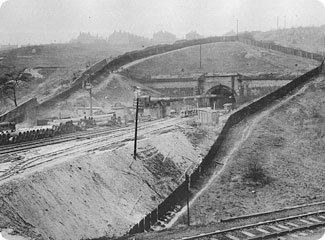
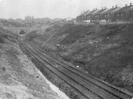
The deep approach cutting at Clifton Hall’s south end, pictured during the late 1950s.
Today a collection of garages mark the spot where 22 and 24 Temple Drive once stood. The tunnel’s southern portal and deep approach cutting have been landscaped to provide a public space. At the north end, vegetation has readopted the trackbed but ground movement occasionally uncovers signs of Clifton Hall’s portal.
This ill-fated structure would never have been cut were it not for the posturing of the Liverpool and Manchester Railway, fiercely protecting a position of dominance. When Captain G Wynne inspected it for the Board of Trade on the 28th December 1849, prior to the official opening, he noted that “the exterior appearance of the work gives every reason to suppose that it has been properly constructed.” He could not have known that a timebomb was concealed within its lining. Five souls discovered that more than a century later.


 April 2013