Twizel Viaduct
Twizel Viaduct
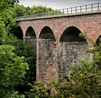
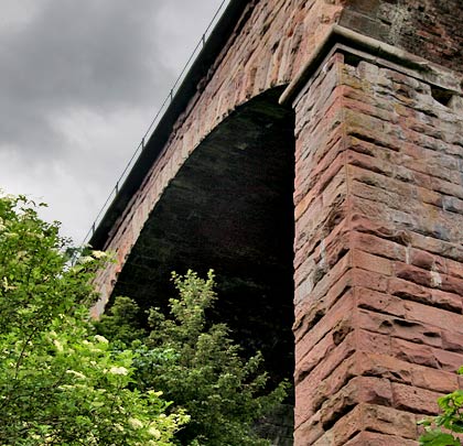
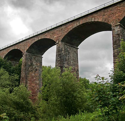
![Like other structures on this section of route, the arches are very flat.](http://www.forgottenrelics.org/wp-content/uploads/2023/03/image1-387.jpg)
![Two piers reflect in the River Till.](http://www.forgottenrelics.org/wp-content/uploads/2023/03/image2-387.jpg)
![The junction of pier and arch, both fashioned from pink stone.](http://www.forgottenrelics.org/wp-content/uploads/2023/03/image3-387.jpg)
![A permission footpath crosses the deck - the result of an agreement between BRB(R) and the county council.](http://www.forgottenrelics.org/wp-content/uploads/2023/03/image4-384.jpg)
![The trackbed is carried across a cloudy sky.](http://www.forgottenrelics.org/wp-content/uploads/2023/03/image5-377.jpg)
![](http://www.forgottenrelics.org/wp-content/uploads/2023/03/image1-387.jpg)
![](http://www.forgottenrelics.org/wp-content/uploads/2023/03/image2-387.jpg)
![](http://www.forgottenrelics.org/wp-content/uploads/2023/03/image3-387.jpg)
![](http://www.forgottenrelics.org/wp-content/uploads/2023/03/image4-384.jpg)
![](http://www.forgottenrelics.org/wp-content/uploads/2023/03/image5-377.jpg)
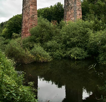
Built between 1846-49 by the York Newcastle & Berwick Railway, Twizel Viaduct comprises six flat arches, extending for 136 yards between its two abutments at a height of 90 feet. Also known as St Cuthbert’s Viaduct, it is now protected by a Grade II listing and looked after by the British Railways Board (Residuary). They know it as structure KLO/26.
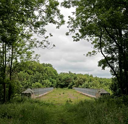
It first took the strain of a train on 27th July 1849 and saw its last one in March 1965, having waved goodbye to its passenger service in June 1964.