


Queen Alexandra bridge
Queen Alexandra bridge

The combined forces of the North Eastern Railway and Sunderland Corporation came together to build a bridge across the River Wear at Sunderland in 1899. The project was prompted by a desire to improve the transport of coal from pits at Washington and Annfield Plain to Sunderland South Docks, as well as benefiting travel locally by replacing the ferry service.
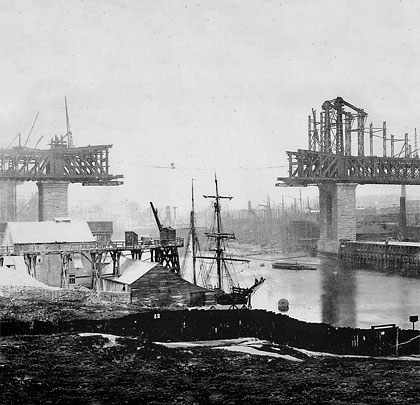
The design, by Charles A Harrison, accommodated two decks, the upper one being designated for rail. Given the job of erecting the main bridge was Sir William Arrol & Co whilst Mitchell Bros of Glasgow constructed the lengthy approach structures. Work began in 1905, taking a little under four years to complete and costing £450,000. In total, 8,500 tonnes of steel, 4,500 tonnes of Norwegian rock-faced granite (used for the foundations, abutments and piers), 60,000 tonnes of red sandstone (brought from Dumfries) and 350,000 bricks were required. Only one fatality was recorded during construction and that was attributed to drunkeness. The Earl of Durham performed the official opening on behalf of Queen Alexandra on 10th June 1909.
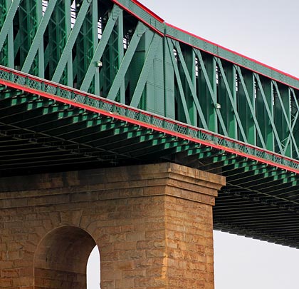
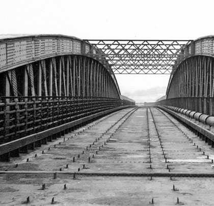
To ensure traffic to nearby shipyards was unaffected, just a single 360-foot span crossed the river at a height not less than 85 feet. It comprised 2,600 tonnes of steelwork. Over the land were three further box-girder spans of 230 feet, each weighing 1,000 tonnes. The main span was built out from opposite sides of the river using a temporary cantilever system, the bowstring steelwork meeting seamlessly in the middle at midday on 15th October 1908. The foundations of the adjacent south pier required just 16 feet of excavation whilst only shale had been reached on the north bank having excavated to a depth of 70 feet.
The rail deck was carried on cross girders riveted to steel columns and tied longitudinally at road level by lattice girders and at rail level by both longitudinal and overhead transverse girders.
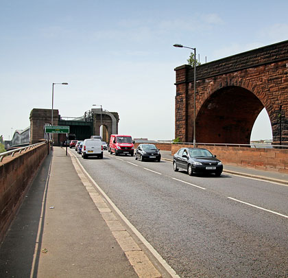
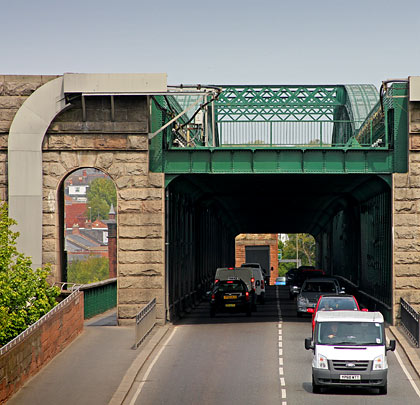
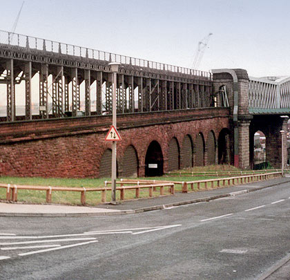
The southern approaches comprised a masonry viaduct leading to a series of iron girder spans sitting above the roadway. On the north side, the railway immediately curved to the west after reaching the end of the main bridge. As a result, only a single girder span was needed to launch the line onto a five-arch (one of which was blind) brick and masonry structure, thereafter crossing Wear Street on a skew bridge.
Initially, around six million tonnes of coal was hauled annually over the bridge by train. But traffic levels quickly declined after the First World War, prompting closure of the railway in 1921. The tracks were removed before World War II; their deck accommodated searchlights and anti-aircraft batteries during the hostilities.
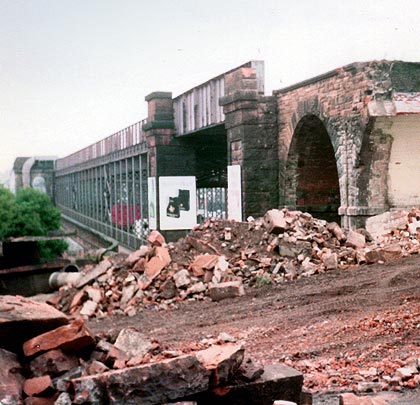
In 1982, plans were taking shape to remove the rail deck, with councillors considering a £11,300 tender for the work. The masonry approach viaduct on the south side was demolished soon thereafter and the steel side spans had gone by 1985, leaving the main bridge and the stone arches on the north bank. May 1984 saw the structure gain a Grade II listing.
In March 2005, Mowlem began work on an 18-month refurbishment which saw the structure repaired and repainted at a cost of £6.3 million. Today the roadway carries more than 30,000 vehicles per day, whilst gas and water mains, electricity cables and a pumped rising-main for sewage are also hosted.
Click here for more of Pinzac55’s pictures.

 October 2012