John O'Gaunt Viaduct
John O’Gaunt Viaduct
![Sunlight catches John O'Gaunt's bright red brickwork.](http://www.forgottenrelics.org/wp-content/uploads/2023/03/image1-315.jpg)
![A rickety fence shelters next to a pier.](http://www.forgottenrelics.org/wp-content/uploads/2023/03/image2-315.jpg)
![Uneven mortar lines suggest a downhill gradient to the north.](http://www.forgottenrelics.org/wp-content/uploads/2023/03/image3-315.jpg)
![A stream meanders under one of the arches.](http://www.forgottenrelics.org/wp-content/uploads/2023/03/image4-312.jpg)
![The structure has seen serious repair and reinforcement.](http://www.forgottenrelics.org/wp-content/uploads/2023/03/image5-306.jpg)
![A substantial parapet stone waits for gravity to take its course.](http://www.forgottenrelics.org/wp-content/uploads/2023/03/image6-296.jpg)
![Clear evidence of new brickwork on the western side.](http://www.forgottenrelics.org/wp-content/uploads/2023/03/image7-277.jpg)
![The original, spalled red brick contrasts with the newer, more durable engineering brick.](http://www.forgottenrelics.org/wp-content/uploads/2023/03/image8-238.jpg)
![One arch in a very sorry state.](http://www.forgottenrelics.org/wp-content/uploads/2023/03/image9-195.jpg)
![The structure still features prominently within the local landscape.](http://www.forgottenrelics.org/wp-content/uploads/2023/03/image10-136.jpg)
![The viaduct is captured with tracks still in situ in September 1961.](http://www.forgottenrelics.org/wp-content/uploads/2023/03/image11-112.jpg)
![](http://www.forgottenrelics.org/wp-content/uploads/2023/03/image1-315.jpg)
![](http://www.forgottenrelics.org/wp-content/uploads/2023/03/image2-315.jpg)
![](http://www.forgottenrelics.org/wp-content/uploads/2023/03/image3-315.jpg)
![](http://www.forgottenrelics.org/wp-content/uploads/2023/03/image4-312.jpg)
![](http://www.forgottenrelics.org/wp-content/uploads/2023/03/image5-306.jpg)
![](http://www.forgottenrelics.org/wp-content/uploads/2023/03/image6-296.jpg)
![](http://www.forgottenrelics.org/wp-content/uploads/2023/03/image7-277.jpg)
![](http://www.forgottenrelics.org/wp-content/uploads/2023/03/image8-238.jpg)
![](http://www.forgottenrelics.org/wp-content/uploads/2023/03/image9-195.jpg)
![](http://www.forgottenrelics.org/wp-content/uploads/2023/03/image10-136.jpg)
![](http://www.forgottenrelics.org/wp-content/uploads/2023/03/image11-112.jpg)
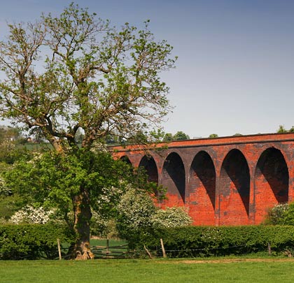
The Great Northern and London & North Western railways opened the southern section of their joint line from Melton Mowbray to the junctions at Welham and Drayton on 15th December 1879. It included a tunnel at East Norton and a viaduct of almost 230 yards over the valley at John O’Gaunt.
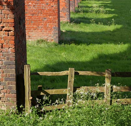
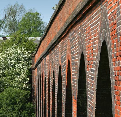
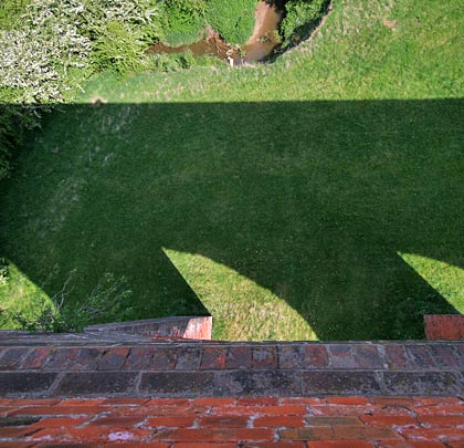
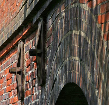
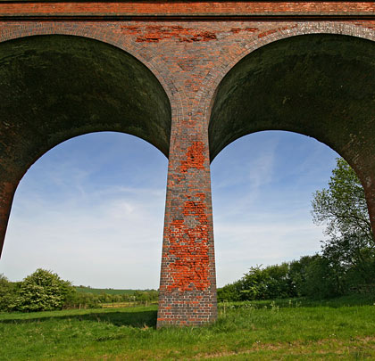
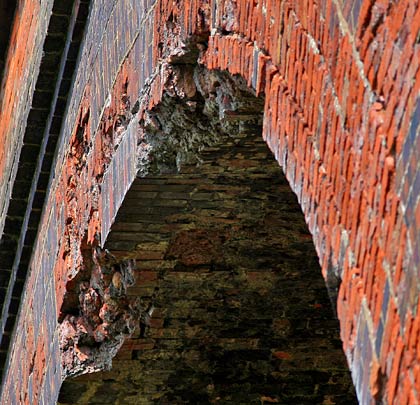
With 14 arches rising to a height of around 60 feet, the impressive structure carried its line on a falling gradient to the north. Today it looks rather sorry for itself – the original red brick is badly spalled in places and has seen extensive patching with more durable blue brindles. From a distance, this gives it an unusual mottled appearance. Cosmetically, the viaduct remains in generally poor condition and you are advised not to stand beneath it for too long, nor lean against the stone copings.
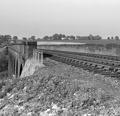
Closure came to John O’Gaunt station in 1957 but goods traffic continued to cross the viaduct until 1st June 1964. In January 1985, a Grade II listing was bestowed upon the structure but this was withdrawn in 1999.