Friargate bridge
Friargate bridge
![Despite the safety netting, the striking elegance of the structure is evident in this view, looking north-west, away from the city. It can be seen that the bridge is two separate structures, requiring eight arches to be cast.](http://www.forgottenrelics.org/wp-content/uploads/2023/03/image1-8.jpg)
![The Georgian frontages of Friar Gate which prompted the demand for a complementary structure. The scaffolded building is Derby City Council’s ‘Pickford’s House’ museum.](http://www.forgottenrelics.org/wp-content/uploads/2023/03/image2-8.jpg)
![Looking south-west towards the former station, the gap between the pair of bridges to accommodate the island platform is clear. Also of note are the elegant bracing pieces between the arches, the dip in the road to allow double-decker trams and trolley buses to clear the bridge and the forlorn red telephone box.](http://www.forgottenrelics.org/wp-content/uploads/2023/03/image3-8.jpg)
![Despite the superb detailing of Handysides’ castings, the poor current state of the bridge is difficult to overlook. The ‘Buck in the Park’ is a symbol of Derby.](http://www.forgottenrelics.org/wp-content/uploads/2023/03/image4-8.jpg)
![A view of the bridge from 1990, after its cosmetic restoration. Comparison with the previous picture underlines the urgent need for full restoration.](http://www.forgottenrelics.org/wp-content/uploads/2023/03/image5-8.jpg)
![Looking between the pair of bridges at the station end, it can be seen that although the parapet panels are plain, the arch spandrels have the same ornate detailing as found on the more visible faces of the bridge. Even here, beside the street, nature is trying to reclaim the structure.](http://www.forgottenrelics.org/wp-content/uploads/2023/03/image6-8.jpg)
![The elevated station site immediately adjacent to the bridge. The entrance was on the other side of the line. The extent of the vegetation in the former platform area is clear.](http://www.forgottenrelics.org/wp-content/uploads/2023/03/image7-8.jpg)
![This is the ‘out of town’ side of the bridge, looking south-east. The station entrance was from the yard to the right.](http://www.forgottenrelics.org/wp-content/uploads/2023/03/image8-5.jpg)
![As with so many grand Victorian railway schemes, there were plans to replace this station entrance with something more imposing, but this ‘temporary’ structure saw the line out.](http://www.forgottenrelics.org/wp-content/uploads/2023/03/image9-3.jpg)
![A view from the island platform in 1990, showing the wall between the pair of bridges and the concrete posts of the former ‘Derby Friargate’ station sign. The building on the right was once used as the District Engineer’s drawing office.](http://www.forgottenrelics.org/wp-content/uploads/2023/03/image10-2.jpg)
![A recent view of the deck towards the site of the 23-arch approach viaduct. Note the waybeams that once carried the rails, the tops of the cast arches and the reverse sides of the dentils below the parapets. The upstanding brackets once carried wooden walkways for use by railway staff.](http://www.forgottenrelics.org/wp-content/uploads/2023/03/image11-2.jpg)
![The founder’s name discreetly but confidently displayed on the inside of one of the arches.](http://www.forgottenrelics.org/wp-content/uploads/2023/03/image12-1.jpg)
![A view of the bridge from the late 19th century, before the road level was lowered.](http://www.forgottenrelics.org/wp-content/uploads/2023/03/image13-1.jpg)
![Captured in the 1940s, the bridge now has become part of the LNER empire.](http://www.forgottenrelics.org/wp-content/uploads/2023/03/image14.jpg)
![A trolleybus passes under the bridge on 18th April 1964.](http://www.forgottenrelics.org/wp-content/uploads/2023/03/image15.jpg)
![](http://www.forgottenrelics.org/wp-content/uploads/2023/03/image1-8.jpg)
![](http://www.forgottenrelics.org/wp-content/uploads/2023/03/image2-8.jpg)
![](http://www.forgottenrelics.org/wp-content/uploads/2023/03/image3-8.jpg)
![](http://www.forgottenrelics.org/wp-content/uploads/2023/03/image4-8.jpg)
![](http://www.forgottenrelics.org/wp-content/uploads/2023/03/image5-8.jpg)
![](http://www.forgottenrelics.org/wp-content/uploads/2023/03/image6-8.jpg)
![](http://www.forgottenrelics.org/wp-content/uploads/2023/03/image7-8.jpg)
![](http://www.forgottenrelics.org/wp-content/uploads/2023/03/image8-5.jpg)
![](http://www.forgottenrelics.org/wp-content/uploads/2023/03/image9-3.jpg)
![](http://www.forgottenrelics.org/wp-content/uploads/2023/03/image10-2.jpg)
![](http://www.forgottenrelics.org/wp-content/uploads/2023/03/image11-2.jpg)
![](http://www.forgottenrelics.org/wp-content/uploads/2023/03/image12-1.jpg)
![](http://www.forgottenrelics.org/wp-content/uploads/2023/03/image13-1.jpg)
![](http://www.forgottenrelics.org/wp-content/uploads/2023/03/image14.jpg)
![](http://www.forgottenrelics.org/wp-content/uploads/2023/03/image15.jpg)
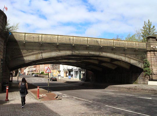
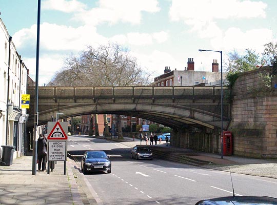
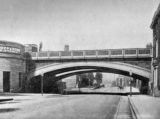
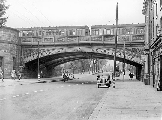
When the Great Northern Railway arrived in Derby to challenge the mighty Midland in the 1870s, it crossed the city roughly at right angles to the existing line, incurring much expense on engineering works. Its station was sited on the fashionable Georgian Friar Gate, much more convenient for the town centre than that of the Midland. In general use, the street name has two words, but railway references omit the space.
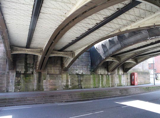
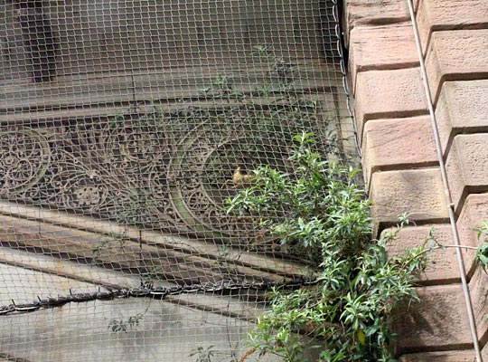
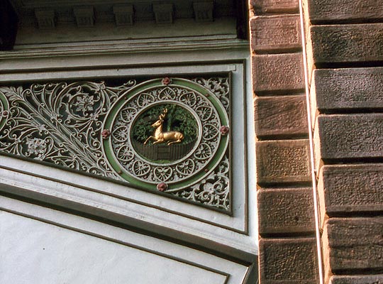
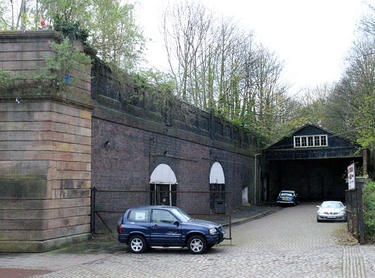
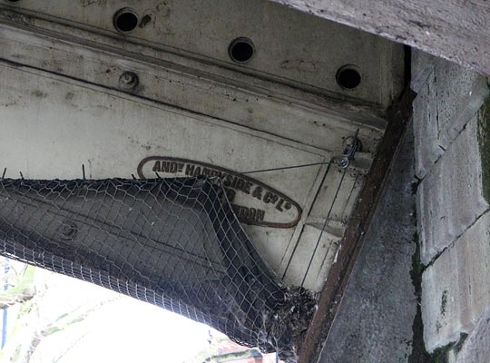
The residents were keen that the new railway should not spoil the ambience of the area and the Great Northern rose to the challenge by commissioning the local foundry of Andrew Handyside to produce a pair of spectacular double-track arched bridges with rich ornamentation and handsome stone abutments. The bridges cross Friar Gate at a slight angle, separating towards the south-western end due to the adjacent station’s island platform. The outer tracks served the excursion platforms, but it seems these were rarely used.
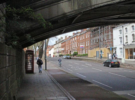
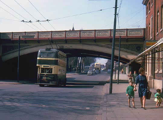
As Friar Gate is a main arterial route, it was provided with a tram line and later with trolley buses. To accommodate the double-deck vehicles and the wires, the road under the bridge was lowered. The approach viaduct to the north-east is said to have inspired Flanagan & Allen’s song Underneath the Arches.
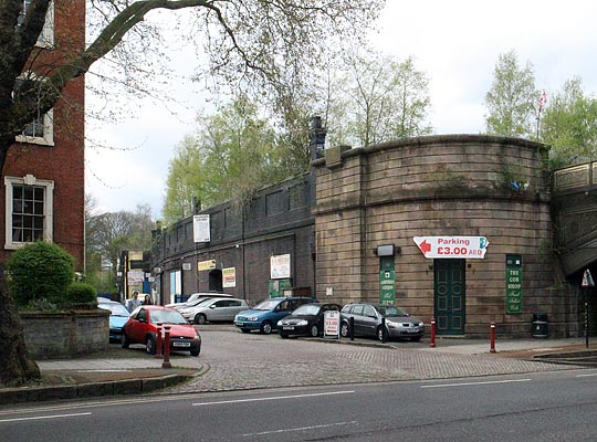
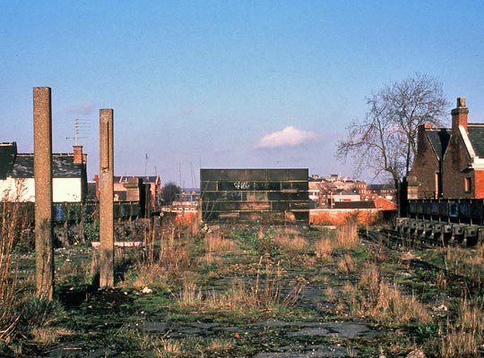
Due mainly to falling revenues from coal movement, the line closed in May 1968. Although the section to the west of Friar Gate was retained for use by British Rail Research, this did not include the bridge. The test track was cut back to Mickleover in the early 1970s and closed completely in 1989.
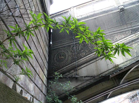
The bridge is now owned by Derby City Council and although it was cosmetically restored to a high standard, it has since fallen into disrepair and is now swathed in safety netting. A vigorous local campaign group, the Friends of Friargate Bridge, is now pressing for a full restoration and a secure future for the structure. In April 2015, the council allocated £260,000 towards this aim, with a view to obtaining substantial further funding from the National Lottery.